Appropriately enough for the day’s walking, I arrived into Mullingar by train at about 8:45 and left got stuck into the walk immediately. The goal for the day was to explore the new greenway that has been laid on an abandoned railway between Mulingar and Athlone.
Mullingar station is a shadow of its former self and the Athlone side of the station is in a relatively poor state of repair. The last service on the line was in 1987 but the line had been in decline from the mid 30’s.
The route starts out along the Royal canal as the last couple of kilometres of railway is still technically active and has been used occasionally for servicing steam excursions. You join the new greenway or “Old Rail Trail” about 2 km out of Mullingar.
The new trail is a tarmac surface and is primarily intended as a cycling route. The majority of people out for the day were cycling with several sets of club cyclists flying along the trail. It was OK as a walker, but I’d be a bit dubious about cycling with wobbly children given the speed that some of these guys were passing.
The trail is laid along the old rails that have been left in place – I assume the scrap value of the rails was less than the cost of lifting them. There is enough space because this was once the Dublin – Galway mainline and so was a double line until the mid 30’s when it was singled due to a shortage of steel an a need for the rails to renew other lines.
As the trail is so new, there is relatively little signage in place except for these very prominent cattle crossing signs mounted on up-ended sleepers.
After a few kilometres I came across a cow who had other ideas about crossing.
The next major feature of note was a short tunnel which was quite exciting. Well, it was somewhere between a long bridge and a short tunnel but as I’ve never walked through a tunnel before I’ll call it a tunnel.
I was making good time at this stage and covered more than 11 km in my first two hours. I was getting ready for a cup of coffee and a spot of chocolate so I stopped at Castletown station 13 km into my trip.

After a quick break and a chat at Castletown, it was back to the trail again. There is a constant but slight gradient uphill all the way to this point but shortly after Castletown the trail peaks and then the gradient is downhill.
The most striking thing about this trail is how arrow straight it is. There are two long sections of almost 10 km each without any sort of a curve on it. This must have been a very fast stretch of railway – much better than the surviving Sligo line which is very twisty in comparison.
All of this straight levelish trail doesn’t make for the most exciting of walks so it was a bit of a relief to come to the ruins of Streamstown station where the old Clara branch split off. This also meant I was past the half-way point between Mullingar and Moate.
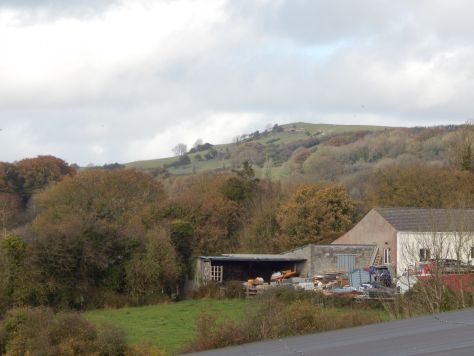
Not long after this, I came across the what I think is the Hill of Uisneach.
At this point I was on the home stretch towards Moate. I probably had enough legs to head on to Athlone but I wasn’t in the mood to completely wear myself out and the hard tarmac surface is a bit hard on the feet – particularly when wearing hiking boots.
I arrived into Moate stations just before three which was a good time for 30 km. The station is derelict but very well looked after.
The water-tower is in particularly good condition which is amazing when you consider it probably hasn’t been used for 50 years.
There is also this particularly impressive looking telegraph pole on the edge of the station.
Anyway, I had an enjoyable day’s walking and it was nice to get a new trail mostly done. I’ll probably try to get back another day to finish it off as it does look as if the most interesting section is that between Athlone and Moate.
870 km


