I fancied a bit of a change for today’s walk and since I had to go into Longford, I took a ramble out to The Junction on the towpath of the long-defunct Longford Branch of the Royal Canal. A little over 5km out from where the N63 goes through the old canal line, you come across the point the Branch joins the canal’s main line.
The Junction was the single most important piece of infrastructure ever built in the county at the time and represented the last piece of an incredible £1.5 million investment in bringing the Royal Canal from Dublin to the Shannon and to Longford town. The 8km Branch took the canal right into a harbour at the back on Longford’s market square before it was filled in the 1960s to build a swimming pool which has since been demolished and replaced with a car-park.
The Branch opened in 1830 but had a very short career as the railway to Mullingar effectively ended the canal as a going concern in 1848. When it reached Longford in 1855 there was little need for the canal except for a few niche purposes such as beer which didn’t take well to being rattled about on the rails. The other main cargo was horse manure which Dublin produced in vast quantities and wasn’t cost effective to transport by rail.
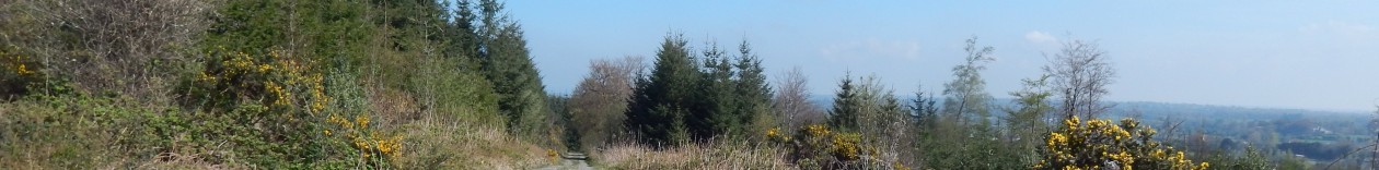
Anyway, for the stretch I was walking there is little left but a deep ditch filled mostly with Birch and Willow trees. There is a good gravel paved path that could do with a little attention and it’s a perfectly flat walk for the 6km stretch I did – the branch took a bit of a winding route to avoid the costly expense of locks.
Appropriately enough for the day’s walking, I arrived into Mullingar by train at about 8:45 and left got stuck into the walk immediately. The goal for the day was to explore the new greenway that has been laid on an abandoned railway between Mulingar and Athlone.
Mullingar station is a shadow of its former self and the Athlone side of the station is in a relatively poor state of repair. The last service on the line was in 1987 but the line had been in decline from the mid 30’s.
The route starts out along the Royal canal as the last couple of kilometres of railway is still technically active and has been used occasionally for servicing steam excursions. You join the new greenway or “Old Rail Trail” about 2 km out of Mullingar.
The new trail is a tarmac surface and is primarily intended as a cycling route. The majority of people out for the day were cycling with several sets of club cyclists flying along the trail. It was OK as a walker, but I’d be a bit dubious about cycling with wobbly children given the speed that some of these guys were passing.
The trail is laid along the old rails that have been left in place – I assume the scrap value of the rails was less than the cost of lifting them. There is enough space because this was once the Dublin – Galway mainline and so was a double line until the mid 30’s when it was singled due to a shortage of steel an a need for the rails to renew other lines.
As the trail is so new, there is relatively little signage in place except for these very prominent cattle crossing signs mounted on up-ended sleepers.
After a few kilometres I came across a cow who had other ideas about crossing.
The next major feature of note was a short tunnel which was quite exciting. Well, it was somewhere between a long bridge and a short tunnel but as I’ve never walked through a tunnel before I’ll call it a tunnel.
I was making good time at this stage and covered more than 11 km in my first two hours. I was getting ready for a cup of coffee and a spot of chocolate so I stopped at Castletown station 13 km into my trip.
After a quick break and a chat at Castletown, it was back to the trail again. There is a constant but slight gradient uphill all the way to this point but shortly after Castletown the trail peaks and then the gradient is downhill.
The most striking thing about this trail is how arrow straight it is. There are two long sections of almost 10 km each without any sort of a curve on it. This must have been a very fast stretch of railway – much better than the surviving Sligo line which is very twisty in comparison.
All of this straight levelish trail doesn’t make for the most exciting of walks so it was a bit of a relief to come to the ruins of Streamstown station where the old Clara branch split off. This also meant I was past the half-way point between Mullingar and Moate.
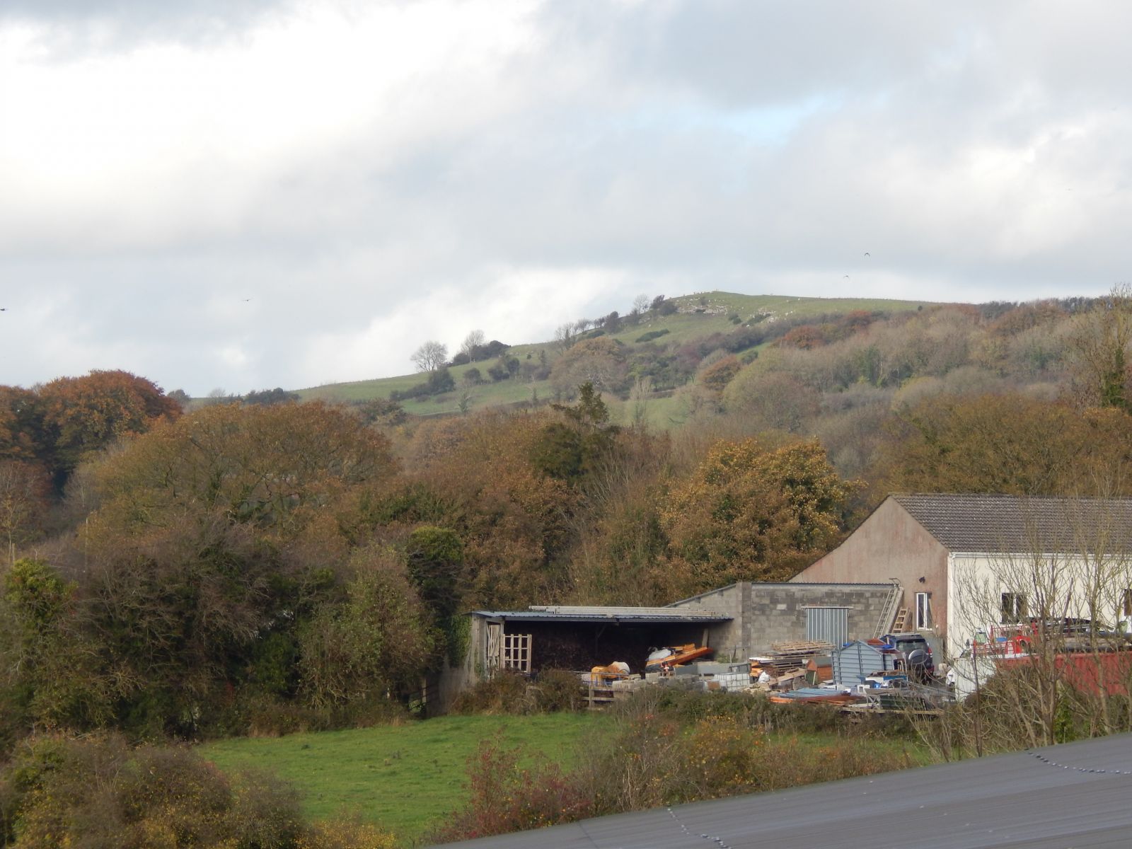
Not long after this, I came across the what I think is the Hill of Uisneach.
At this point I was on the home stretch towards Moate. I probably had enough legs to head on to Athlone but I wasn’t in the mood to completely wear myself out and the hard tarmac surface is a bit hard on the feet – particularly when wearing hiking boots.
I arrived into Moate stations just before three which was a good time for 30 km. The station is derelict but very well looked after.
The water-tower is in particularly good condition which is amazing when you consider it probably hasn’t been used for 50 years.
There is also this particularly impressive looking telegraph pole on the edge of the station.
Anyway, I had an enjoyable day’s walking and it was nice to get a new trail mostly done. I’ll probably try to get back another day to finish it off as it does look as if the most interesting section is that between Athlone and Moate.
After quite an extended break from long walks, I finally managed to get out for a walk over the weekend. As it was on short notice, I just did a canal walk into Mullingar on a route I’ve done four times now. I started out from Fowlard’s bridge at about 8:30 and set off towards Abbeyshrule.
It was a fine sunny morning but it really was quite windy and the weather had a general air of unreliability about it. Still, it was pleasant enough going even if the grass had a heavy dew on it which saturated my boots quite quickly. A little dampness made it through the GoreTex but nothing too bad.
I arrived into Abbeyshrule after about an hour. There had been a helicopter crash in the village about a month earlier and it was really impressive how well they had cleared up.
From here it was a quick walk onto the Richmond aquaduct and on towards the really wild part around Bog bridge. This is possibly my favourite part of the entire canal and I had been quite alarmed to hear that they were putting down a proper path. But they have actually made a really good job and put the path down on the northern side of the canal and left the existing wild side alone.
I headed on towards Emper and took a coffee break at one of the locks there before pushing on to Ballinacarrigy. I nipped into a shop there to buy myself an ice-cream and kept going.
It was fairly easy going and the weather remained dry enough as I carried on. The wind was really starting to pick up. I had resolved to wait until Coolnahay for my lunch so was starting to get a bit tired. There was quite a bit of wildlife about.
As I got closer to Coolnahay I was starting to get quite tired after my morning’s walking. Somebody keeps a few donkeys on the far bank a few hundred metres out of Coolnahay so I was glad to see these guys.
After about 15 minutes stopped at Coolnahay, I got going again. It wasn’t long before I passed the ugly modern bridge which marks the half-way point between Coolnahay and Ballinea.
After another quick stop at Ballinea, I came across the old Mullingar to Athlone railway which is being converted into a greenway. Although it wasn’t technically open yet I heard voices on it and so nipped through a gap in the hedge onto a pristine new cycleway.
It wasn’t the best of walking surfaces but it was interesting to walk along the old railway. This used to be a double line so there was enough room to leave the greenway beside the existing track. I’m not sure why they left the track in place though as the sleepers are so rotted that it would need lifting and relaying anyway if it were ever to be used again.
I stopped for a little sit down on a platform after a bit as I was getting near to be my destination and I knew I’d have about half an hour to kill before my train was due.
This is still technically an open railway so somebody has hung a sign with a stop signal on it from an old signal post.
I arrived into Mullingar station after about 7 hours on the trail of just short of 34 km. It was a nice way to restart my long walks.
It was a miserable morning when I got up and I wasn’t going to finish the trail just for the sake of it so we had a leisurely breakfast and pottered about for a couple of hours. By then it had cleared up enough that the walk would be a pleasure rather than a chore so I sorted myself out and set off.
The old station is at the back of the hotel and while the station building itself is in poor shape, this water tower has survived in a reasonable state. You can see the bike rack used by hotel guests here.
There is also a bit of the platform visible here.
I set off at a reasonable pace but not too hectic as I had a few aches and pains from yesterday. I quickly left the village behind and this section was properly set up on the old rail alignment so there were a few deep cuttings and over-bridges along the way.
There were some spectacular views of the countryside as we emerged from the cutting just outside Mulranny.
This bit of countryside is almost an island with only a kilometer or so attaching it to the mainland so the coastline comes in a long way. At this point we are about 8 kilometers from the open sea.
At this stage I was settling into the walk and making good progress. It was very enjoyable with a proper off-road track and interesting scenery. There were quite a few cyclists about – it being a Saturday on a bank holiday weekend, but I wasn’t seeing any walkers at all aside from one or two strolling a kilometer or two out of Mulranny. The going stayed good.
The heather was in fine form.
After about 4 km we headed inland for a bit with a trek across fairly desolate moorland and then came back to the sea.
At this point it all came kind of crashing to end. At about the 7km point, the route joined the main road into the Achill and it was a nasty kilometer or so right on the edge of the Achill road with no footpath. At one stage my hat was blown off by a truck thundering by about three feet away from me but I did recover it. The good news is that they are widening the road here so there will probably be a proper path in place by the end of the summer but that didn’t do me much good.
When that was over, I decided to take a short break to eat a sandwich. Although it was’t a long walk, it was lunchtime and I was getting a bit hungry. Shortly after getting started again, we left the main road behind and headed along the old route again.
For the next couple of kilometers it was sections like this alternated with short stretches of minor roads. At about the 10 km point we left the off-road sections altogether and the reset of the walk was on minor roads. There wasn’t any traffic though so it wasn’t really an imposition.
It was getting a bit of a trudge at this stage and I was counting down the kilometers. I started meeting a few walkers so it couldn’t be a lot longer. The path took a sharp turn to the left at about 13 km and we rejoined the main road. As I had somebody waiting for me in Achill and I didn’t really fancy trudging the 500m or so into Achill along the side of a main road, I bailed out at this stage as I had had enough of main roads.
My conclusions on the greenway were a bit mixed. It is a bit over-hyped and it would certainly not be worth making the journey to walk it. For the non-serious cyclist, it makes a lovely outing with relatively little interaction with traffic. The section between Newport and Mulranny is the best followed by Mulranny to Achill but I really wouldn’t be bothered with Westport to Newport again unless I determined to complete the whole route.
The canal route is a far preferable journey for walkers and I’ll be returning to that next month with the long section from Mullingar to Enfield although I may need to review my footwear situation before then.
This followed straight on from the previous section and I didn’t even stop in Newport as I was hoping to get half the total 31 km done before stopping for lunch. So I pushed on another few kilometers. The picture didn’t immediately improved with the route following the N59 for another couple of kilometers but at least it was properly separated. There were some fine views over some rather convoluted sea inlets along this section.
However, we quickly got to the point of leaving the main road behind altogether as the route took a detour off across this fine old bridge
After a quick tango with the main road for 50 metres, the route left the road behind for good for the rest of the day so I decided to call a halt to proceedings a few hundred metres early after coming across a nice picnic bench to have my lunch
I ate well of tuna sandwich and soup and had a nice sit down for about 15 minutes. Suitably refreshed, topped up my water bladder, packed up my bag and set off again. I was still keeping a reasonable pace, taking about 11 and a half minutes to do a kilometer. However, my overly stiff hiking boots and some incredibly expensive and ultimately useless summer hiking socks were starting to take their toll on my feet. I had to stop and adjust the lacing on one boot a couple of times.
The countryside here stated to turn spectacular and we were really into the wilds and on a proper wild greenway walk. There were very few people about, I was being passed by a cyclist maybe every half hour or so and it was a fantastic wild experience. I heard a cuckoo around here which is something that has gotten pretty rare in the midlands. The countryside alternated between exposed wild moorland the odd sheltered little pocket.
There were some fabulous pockets of bluebells about.
The greenway has quite a few quirky pieces of art installed to keep one’s interest I’m not quite sure what the idea was as the countryside in this section is quite enough to keep me interested
At this point, I was close to the 25 km mark for the day and with it all being on hard surface my feet were really starting to hurt. However, the distance was winding down and I was on the home stretch with a bit over an hour remaining and the promise of a hotel with a hot-tub and a sauna to sort my aching muscles out.
This is a typical scene from a river crossing with the whin bushes in fine form. The smell was powerful at times. There was another cuckoo on the go in this area.
Somebody had gone to a lot of effort putting together this fine dry stone wall. It was in fine shape but doesn’t have the appearance of a typical railway structure.
Finally after over six hours on the move, Mulranny came into sight. I got a message to say that my family were coming to meet me and walk with me on the last mile or so to the hotel. It was nice to have an excuse to slow down to match the pace of my children.
I arrived into the hotel just short of 7 hours after getting off the train with probably about 40 minutes of stops along the way having walked around 33 kilometers. So not a bad day’s work for me. I decided to play it by ear regarding completing the walk on the next day as I wasn’t going to get myself into a state of being useless for the weekend.
I’ve dropped in my Endomondo log for the walk but it has a bit lopped off each end due to me not starting it at the station in Westport and my phone crashing 5 minutes from the end of the walk. I was lucky not to lose the log altogether.
As we were planning on spending a weekend in Mayo, I decided to head down on the morning of the first day to break the back of walking the Great Western Greenway which is advertised as running from Westport to Achill Sound along the route of the old narrow-gauge railway that ran until 1937.
So I found myself on the 7:35 Heuston – Westport train at Athlone at 9 am on Friday embarking on a rather roundabout way of getting myself to Mulranny for the night. We arrived into Westport on time at 11 am and I sorted myself out for the walk. After a few km of walking, I managed to find the trail which wasn’t terribly well signposted from the station. I say not terribly well as I didn’t see a sign although there may have been one.
I started my walk tracker on my phone after about 20 minutes walking as I had wanted to leave it until I started the trail properly but figured I had missed the very start by now. Anyway, after walking a couple of kilometers through Westport and then out the Newport road I found the trail and settled into the walk. The first couple of kilometers were quite enjoyableand an easy way to settle into the journey. It was a fine off-road track with odd bit of old railway architecture to keep oneself interested.
The route passed through quite a few fine old bridges which seem to have been reasonably well maintained over the years. The same cannot be said for many of the bridges that the railway passed over as most of these have had to be replaced with modern steel structures. I’ll add a couple of pictures of these later.
There were a few lovely bits of planting along the line – a few people around here appear to have taken on to extend their gardens into the greenway which is nice to see.
Wild garlic appears to thrive in this area – at least this is what I think this is. There were lots of bluebells about as well but I didn’t think to take many pictures so don’t have a decent one.
I stopped for a break about 90 minutes in and sat down for five minutes to have a coffee, a few nuts and to refill the bladder for my water tube. It was good to have a break but not a terribly inspiring place.
Here is the first of the replacement steel bridges to fix the old work-out structures of the railway. I guess a lot of the old bridges were probably steel structures and were either sold for scrap or just rusted away.
Unfortunately the good route didn’t continue for long. We quickly ended up running alongside the N59 and there was a constant stream of traffic and the associated noise which didn’t make for a terribly peaceful walk at all. Indeed we had several long stretches right alongside the road with views like this.
It started getting ridiculous after about 7 km when we had a long run into Newport right alongside the main road with just a 20 cm fence separating us. I think that if I had been coming the other way I would have just given up and called a taxi at this stage.
However, there were signs of development of the trail around here with a couple of sections looking finished and read to take the trail off the road properly. I arrived into Newport after about 2 and half hours of proper walking and fervently hoped things would get better as we moved out onto the wilder country to the West.
It would have been so much better to walk into Newport across the old viaduct, but the main route takes us across the road bridge and right through the town. I was packed for the day but if I had wanted to lighten the load a bit, it would have been easy to get food and water for the second half of the walk in Newport.
Walking forests and trails in the midlands of Ireland