This was really just an afternoon stroll with my daughter from Brannigan harbour to a bit beyond Archie’s bridge and then back again. This is a section I’ve walked a few times but it is worth visiting again.
It was a fine sunny afternoon and there were a few people out enjoying the weather. We weren’t exactly making a huge pace so I did a bit of messing about with the camera.
The cowslips were in fine form – they are quite rare nowadays but do well in ungrazed areas like the canal bank.
We kept going past Archie’s bridge for a few hundred metres but we weren’t really out to bust ourselves so turned with a bit over 3 km done.
The walk back was fairly uneventful – just a nice bit of a stroll for the afternoon.
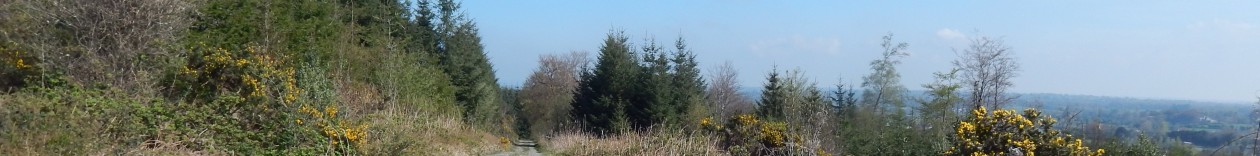
After passing the M50, I quickly got the sense of leaving the city behind. But not before passing this odd little setup. I’m not sure if this is supposed to be advertising this guy’s business or if it serves some other purpose.
Anyway, I quickly came to Clondalkin where I nipped into a garage to get myself something cold to drink – I was getting a bit bored of water. This would have been an ideal spot to stop for a bit of lunch and there was a pub there that would probably have done at least a toasty for a spot of lunch.
After this interruption I continued on towards Hazelhatch but it was becoming fairly apparent that I wasn’t going to make it to Sallins which was always going to be a bit of a stretch at 46 km.
At the next lock, there was the first of these odd-looking lock-houses. This was part of the stretch of canal built by Thomas Omer and he must have had rather grand plans for the locks as these are very substantial particular in comparison to the equivalent cottages on the Royal Canal. These would have been very large for a lock-keeper in the day so perhaps the ground floor was used for some commercial purpose such as toll-collecting.
The going was still good with a well-made path along the canal and there were still quite a few people out walking and cycling although perhaps not as many as before.
The bridge ahead turned out to be a pedestrian bridge and there was a greed route signposted to cross it. I didn’t bother and just stuck to the tow-path.
At the 13th lock, there were a few mill buildings. The lock-house was a couple of hundred metres up the canal which struck me as a little odd. The Royal lock-keeper cottages are normally right by the lock – maybe this was a lesson learned.
From here on, the going got significantly worse. Due to the very heavy recent rainfall, the canal was very full and the banks weren’t in terribly good condition. So there was quite a bit of flooding on the path and in places there was water flowing from the canal into surrounding fields.
I came across this interesting old bridge in the middle of nowhere. Probably this was someplace that had become depopulated over the years and the bridge was only used by one or two farmers nowadays.
Yes another of the strange lock-houses and this one is in particularly bad condition. It is odd that all of the lock-houses are derelict and in such bad condition. The equivalents on the Royal seem to be very much still in use.
This is an overflow stream from the canal and the water was fairly roaring down it.
At this stage, it was well past 2:30 and there was no way I was going to make another 13 kilometres to Sallins before dark. In any case, I had kind of had enough of walking with a tally of 33 kilometres for the day so I decided enough was enough at Hazelhatch.
There was a lovely looking pub there but I didn’t partake due to having a train to catch and I would have to drive home from the station at the other end so I headed for the railway station which was about half a kilometer up the road on the right-hand side of the canal.
I was straight into the next section of the walk which involved making a start on the Grand canal. This is the older of the two main midland canals in Ireland and was started in 1756. It now connects Dublin and the Shannon and is purely a recreational facility nowadays.
The start of the canal is a rather large basin that originally started out as a reservoir for the city. It must have once been a hive of activity for the transfer of cargo between ships and canal boats and there were once several large mills on the basin. Nowadays, it is mostly decorative. I used to divemaster for a diving school based on a ship in the basin and have dived it numerous times. It isn’t exactly interesting – it is about 5 metres deep but serves as a useful step between the swimming pool and the open water for trainees.
This whole area has been completely redeveloped over the last 10 years and used to be the main gasworks for the city. Although much of it was empty during the worst of the recession, the area is coming to life now and should become an important part of city life over the next few years.
This is the a new theatre on the basin and is one of the main draws to the area. It is all looking rather fabulous on this beautiful morning. It feels like mitching school since there is nobody around – everyone is at work on this fine Friday morning.
This is the Naomh Eanna – the ship that used to be a dive shop. She spent 30 years as the Arran Islands ferry before spending roughly as long again tied up in the basin and home to a dive shop and a surf shop. She’s seen better days but there are moves afoot to move her to Galway and set up as a hostel. It will be interesting to see what happens.
Here’s another view of the Naomh Eanna with the Poolbeg Chimneys behind them. These are another piece of endangered industrial heritage as the power station is no longer operational so they are currently surplus to requirements.
Anyway, back to my walk. I quickly left the basin behind and came across a nice market that was setting up on the canal bank just past the first bridge. Unfortunately I forgot to take any pictures, so you’ll have to take my word for it.
As I crossed the bridge you can see Landsdowne Road stadium as a backdrop to the traffic jams. I know the next section of the canal pretty well as I spent quite a few years living in this part of the city and so used to walk it quite regularly. It is a fantastic linear part through the south city centre.
I quickly passed Baggot Street which was somewhat of a writers’ haunt in the past. There are benches dedicated to Percy French and Paddy Kavanagh which look pretty nice once you sweep the empty beer cans off them.
I continue on towards Portabello and pass under the Luas (tram) bridge near Ranelagh.
This is a real leafy part of the city and the canal is a fantastic amenity of those who live and work here.
Just after passing Latouch Bridge (Portabello), I take a coffee break – my first of the day. Notice the odd lock numbering. The prefix is because this part of the canal was originally a branch to the main canal which ended up near the Guinness Brewery. The branch was built around 1795 and is called the Circular line (hence Lock C7).
At this point I sort of stopped faffing about with the camera and started trying to make some distance. For the next 7 or 8 kilometers, the canal passes through some roughish areas like Dolphin’s Barn, Rialto and Ballyfermot. While these areas have become a lot quieter over the last few years, it would probably still be unwise to walk through them in hiking gear waving a camera about in the late afternoon or evening.
Nevertheless, the canal banks are still well-maintained and litter free and is a very pleasant walk. Despite spending 15 years of my life living in and around the city, I’ve never walked this area so it interesting to explore some relatively familiar areas from a different perspective. This is often the case when walking the canal. You’ll see somewhere from an angle you’ve never seen before and you might never even have realised the canal was there.
After another couple of kilometers I come upon Suir Road Luas stop which is where the Circular Line joined the main line.
The bridges in this part of the canal are interesting. On the Royal almost all the bridges cross the canal square on but most of the bridges on the Circular line cross at angles. This was more expensive at the time but must have been a condition of getting the licence to build the line in what even then would have been expensive suburban villages near the city.
This is a view down the old main line. This was filled in during the mid 70s although I think the basin survived a lot longer. The alignment is now used for the Luas tram-line.
This is lock 1 proper on the main line. At this stage I was coming up on the 20km mark for the day. The tram-line follows the canal for a couple of kilometres at this point but we soon leave it behind.
The weather was holding out nicely as I passed into Ballyfermot. The scenery around here is quite industrial with a lot of pylons and substations about.
I stopped for a rest near the City West complex which is a rather large office development and industrial park on the western edge of the city. They have a rather cool sculpture thing that you can see from the motorway but again this is a new perspective on it for me.
Shortly afterwards we come to the M50 – the main orbital motorway around the system and it crosses over the canal. Given that this is the natural edge of the city, this seems a natural point to break this post.
Walking forests and trails in the midlands of Ireland