I set off my fairly regular loop of Kilronan mountain from Keadue shortly before 9. There was an ominous looking cloud hanging over the mountain but I figured it would probably clear by the time it was up there and I had map and compass handy anyway.
By now I know this route pretty well and didn’t really have to bother with the map. I headed out of the village, turned left and started heading up the hill.
The route climbs sharply for the first three kilometres or so. First it’s on minor roads before switching to odd an old track. This takes you right past an old sweat house. Then you pass a cairn that was built to commemorate the victory of a candidate in the 1918 general election.
Not far after here we split away from the miners’ way proper and the trick is to follow the red way-markers although they may change colour soon since there are a whole load of new waymarker posts installed. The route takes you towards and then pass a row of wind-turbines.
I had a quick stop for coffee and a banana at the end of the turbines and as it was getting quite windy, I put on my raincoat and gloves. After this welcome break, I headed on towards the abandoned mine.
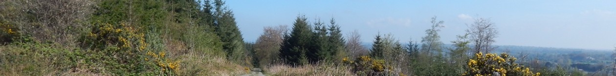
From here it’s on to another short road section before going back to tracks and eventually going on animal tracks across the bogs. The mist had long cleared and the views from here were quite spectacular.
I was getting due another break so stopped at 10 km and had a rest against a peat hag to get out of the wind. This has this Devil’s matchstick in spore.
After my break, I passed this holy well which pretty much marked the highest point of the day and the end of the rough tracks. About 400m past this, I joined a rough old mountain road and started heading down.
There seems to be all sorts of interesting things in spore as I went down – there were loads of horsetails.
From here on, it was a fairly simple road walk and it was getting time for lunch. I headed on until I passed the 15 km mark and had lunch on a little bridge on a fairly busy regional road. Suitable refreshed, I headed on towards Ballyfarnon
From here I headed through the Kilronan castle estate and ended up back in Keadue 6 hours after I’d left it.
This walk is becoming a bit of a habit – this is my third time this year doing the entire walk and I’ve done part of it a fourth time. Anyway, it’s a nice walk and quite close to home so it doesn’t require a lot of planning. It is basically a matter of parking up in Keadue and setting off at a reasonable hour of the morning.
After a couple of kilometres of a road-walk towards Arigna, you quickly start to ascend for fabulous views over the countryside.
There is a good steep climb up an old foot-path until you come to a sweat house right by the pass. I had a look in here on a previous walk but I didn’t bother stopping here.
After this, you’re properly up on the mountain in peace an quiet. The heather up here is even more spectacular than that on my home walk. The weather was quite annoying with regular light showers that just got heavy enough to make you put your rain jacket on before stopping.
There is the usual view of Sliabh Aniarann covered in clouds. The only time I’ve managed to see the mountain from here was an inverse view where everything else was covered in clouds and the peak was poking out.
I trundled on towards the wind-farm that runs along the ridge. It was becalmed today though so nothing was moving.
I wasn’t exactly making great time but then I wasn’t in much of a hurry. I stopped for a snack at the abandoned mineworks before rejoining the road for a bit. The way-marking here is a bit weak but I know the way so it isn’t so much of a problem. In particular, you need to very careful about leaving the track towards the saint’s grave. There is an abandoned engine which you need to pass on the track above it. From here, a single waymarker is just visible in the distance. If you pass this engine with it on your right, you’re going the wrong way.
From here it’s another couple of kilometres before you join the Miners’ Way track that leads you down towards Ballyfarnon.
This track winds its way down the mountain and gradually turns into a proper road before crossing a stream and heading back towards some form of civilisation. I stopped again for coffee and a snack for a few minutes and resolved to have a lunch break at Ballyfarnon.
From here the route is mostly a lowland road walk but it’s mostly along very minor roads and a couple of kilometres are along a green road. I arrived into Ballyfarnon at about 1:30 and had a 20 minute break for soup, a sandwich and some crisps.
I had a nice final few kilometres through the Kilronan castle grounds. I spotted this interesting little fungus on the forest track.
After passing through the old castle gate, I made my way alongside the road into Keadue. I stopped at the graveyard there to try to find O’Carolan’s grave but didn’t have any luck. I made into Keadue around 3:30 a bit over six hours after I left.
I found myself in Ballyfarnon at about 8:30 on a Saturday morning putting my boots on for my last section of the Miners’ Way which I’d planned as a 35km section from Ballyfarnon through Castlebaldwin and on to Boyle. It was a fairly fine morning – overcast but dry.
As I was setting off, a group of cyclists stopped for a break and we exchanged greetings. I got myself moving and soon left the village behind without much fuss. For the first time in ages, I had very little ground to cover again. After about a kilometre I passed the junction between the two sections and was on virgin territory again.
There are quite a few lakes in the area but the main feature of the walk for the day was to be Lough Arrow as the route essentially does a massive loop around the lake. The lane I’m walking gets progressive narrower and greener until it turns into a lovely little green road.
There is a really striking purple flower that does really well in this area and looks a bit like a hyacinth. They seem to be quite widely distributed on verges in the general area.
I continue on this green road for a bit – the route around here is quite hilly and there is quite a bit of up and town. However, the going is easy – all of the route is on roads or dry tracks and there is little opportunity to get wet feet. Indeed a good part of the first few kilometres is also marked as a cycle route.
A bit further on the route drops down past an interesting looking outcrop – the landscape is quite rock.
After this the route wends its way between two little lakes – White lough and Black Lock. White lock is first and opens out over a relatively flat shoreline.
Black lough is the opposite with cliffs on one side and all the banks very steep indeed. The surface of Black lough is mirror-like in its stillness.
After passing these I have a sudden climb to contend with which leaves me quite out of breath. This day is going to have a lot of upping and downing before I’m done.
As I head further south the landscape becomes a bit odd – there are a lot of glacial erratic boulders on the ground and some of these are truly massive. In the area where I live there are quite a lot of these as well, but they are generally buried and you’ll only discover them when you try to remove a stone from the lawn and then find out your dealing with a 10 tonne rock.
The route leaves the road for a kilometre or so while it ascends a small hill with a trig point on top. There are clear views from here about 30 or 40 kilometres to the northwest and to the south so I guess is a good spot for a trig point.
From here I descended onto a road for a bit and then back off road for a couple of kilometres before I end up in a hotel carpark. On the way the route passes this rather fabulous dolmen.
This is a really impressive site and is associated with the legend of Diarmuid and Gráinne. I had a cup of coffee and a snack here and rested for 5 minutes before pushing on through the forest and towards Cromleach Lodge and on towards Arrow river which the route crosses at the very head of Lough Arrow.
A few hundred metres after this, the route takes a short-cut across some fields and it is a quick couple of kilometres up into Castlebaldwin. There was a large road-house type restaurant here that serves food all day and I was very tempted to stop and have a hot meal. However, it was just a little early to be taking a lunch break so I pushed on towards Carrowkeel.
This route was quite interesting and we took a detour through a donkey sanctuary before heading up into the hills towards the Carrowkeel Megalithic Tomb. I pushed on for an hour or so beyond Castlebaldwin until I was well past the 20 km mark and could stop for lunch confident I had more than half of the day’s walking done.
Suitably refreshed after a lunch of ham sandwiches and crisps I headed up between the two rocky ridges and into a rather fantastic landscape. You can see the ridge on the left from the main road but the one on the right is really striking as the cliff-face on it continues on for about 4 kilometres.
After about 20 minutes, I came to a sign where the route splits from the path to Carrowkeel. I really wanted to take a look but it was marked as a kilometre off the route and I didn’t really want to add two kilometres to my day.
This terrain continued for a couple of kilometres before I descended into a valley and back up the other side of one of these ridges
Amazingly there was even a ruined cottage up here. Talk about living in the middle of nowhere.
At this point I started descending into a valley. This went down a lovely green road and past another couple of ruined cottages. Before long, I joined paved road for a couple of kilometres before heading off up again into the Curlew mountains.
This is the view from down the bottom looking back up towards the ridge.
At this point the rain that had been threatening all day got serious about things and I ended up putting my camera away so I only took a couple more shots with my phone. The route headed off through a forest road which was quite seriously littered with old beds and sofas.
With about 4 km to go, I joined the old N4 road which is now a country road since the Curlew Mountains bypass was built. The route has an off-road path here since this used to be such a major road but the terrain is horrible and I probably would have been better off sticking to the road.
The route started off reasonably well with forest track and well-made wooden bridges but then deteriorated badly into a hack across forest drainage channels and then a mixture of ankle sucking mud and moss. It emerged from the forest and then across some moorland with barely a hint of a track aside from the waymarkers. This two kilometres took me nearly 45 minutes to traverse which I could have done without.
I was seriously glad to emerge onto a road from where it was a simple couple of kilometres down into Boyle town where I took a taxi back to Ballyfarnon to pick up my car. All in all, it was a very successful day’s walking which completed my Miners’ Way.
I was back to the Miners’ Way for the day and although I planned on getting the bulk of the remains of it done, the weather had other ideas. But it started out OK. I left Arigna village at about 08:30 and started on about a 5km walk-in to my starting point on the loop itself. I didn’t follow the official route as that would have given me at least twice the distance back-tracking and I wasn’t really up for that.
The weather was overcast but dry – perfect walking conditions really even it was a bit misty. The initial couple of kilometres was easy enough going with a gradual incline taking me up into the hills. I did spot this rather fabulous horsetail on the side of the road.
After a couple of kilometres, I turned off the road I was on and started heading up into the hills properly. This was quite a steep climb but the views were kind of worth it.
I came across this lovely thatched cottage but it wasn’t long before I left the houses behind. Although the Irish love to build everywhere, once you get into the proper uplands they tend not to bother so much.
As I headed up the hill, the windfarm on the mountain starts to loom overhead and there is a low rhythmic swoosh as the nearby turbine is turning fast in the stiff breeze. These turbines will be a major feature of the walk as the route takes me right around them. A lot of people complain about them, but they are a lot easier on the landscape than the coal mining that went before them.
As I crest the mountain, I got a fabulous view of Lough Allen although it is somewhat obscured by mist. Sliabh Aniarainn is hidden in clouds as usual.
I get a bit of a break from climbing and the route flattens out for a kilometre or so until I rejoin the Miners’ Way properly at a ruined house where I took a break for lunch on my walk from Dowra to Dromshanbo.
One of the slightly unfortunate features of the Miners’ Way is that it is very difficult to complete it without covering parts of it two or three times. So with this in mind, I backtracked along the route to towards Dowra for another kilometre until I came to the branch point.
And yes, the marks on one of the sign do appear to be from shotgun pellets.
I took the turn and started heading off up towards what is probably the wildest bit of the walk I’ve seen so far. This part of it follows an old quarry road and ends up in the wind-farm. All around are various rock faces and piles of earth that are the result of previous mining.
You get a real sense of this being the Real Miners’ Way. There are a few other industrial highlights, but none of them seem quite so isolated and in such an unlikely place. When you get to the top, there is this strange expanse of gravel – it is hard to know if this old or if was excavated when they were putting up the wind-farm.
By now, it was starting to drizzle a bit but nothing too upsetting. I started down the access road for the wind-farm for a bit until the route turned off across a bog before heading down the mountain. This was to be a bit of an up-and-down day as the route took me up out of Arigna, then down into the a valley before going up Kilronan Mountain. So I went down across the bog, then through some cut-away forestry that was probably really nice a couple of years ago.
After crossing a road, I took a coffee break before continuing down a lovely grassy road through a forest. This looks like it used to be a proper road as it ends up in ruined cottage.
This would have been a nicer spot for my coffee break but no worry – I continued downhill until I came to a rather substantial river with a fairly new steel bridge across it.
From here I headed up through the forest until I came to another track that used to be road.
This took me up by an old ruined school that obviously had a very short operational lifespan since it was only built in 1955. It was in a pretty sorry state.
By now the rain was starting to get a bit serious about things which was making life a bit difficult.
I followed the old road up for another hundred and fifty metres or so and came across a nice little church and grotto.
Then I followed the road for a bit before the route headed off into another patch of forestry and steeply upwards towards Kilronan mountain. By now the rain was getting quite bad and I had to put the camera away as it was really getting quite wet. So of necessity there will be little more photography.
It was a pretty steep climb up the side of Kilronan Mountain but it was all over quite quickly and the route followed a a contour for a couple of kilometres. On a better day there would have been a fabulous view here but there was nothing much to see today unfortunately.
Futher on, there was a bit of karst landscape with an exposed area of rock. On this I spotted some lichen in spore which added a vivid splash of colour.
By now the rain was really getting quite nasty and the wind had also come up so I was getting really soaked. I started to think about bailing out since there was little point in walking for another 4 or 5 hours in this. But since I was in the middle of nowhere I still had another hour or two to get to somewhere that I could get collected.
So I struggled across the exposed moorland until I came to a track which started bring me down towards more sheltered ground. I quickly joined up with the Kilronan loop by which time I was recovering ground I’d done before.
Down by the bridge where I had lunch on another walk I came across this rather pretty purple bluebell and there were a few more along the bank here. At this point it really started bucketing rain and I decided to give up on my day’s goal and just head for Ballyfarnon. I’m not going to bother with a detailed description of the remaining 4 kilometres of road walk as I’ve done it twice before.
It wasn’t the most successful day’s walking but I still managed almost 25 kilometres and a reasonable amount of ascent so it wasn’t too bad. All that remains of the Miners’ way is about 25 km of relatively accessible route between Ballyfarnon and Boyle so I’ll have to return another day.
I had promised to do Kilronan Mountain again as a recce for a potential group walk so we arranged to do it this morning as a nice second walk of the long weekend. In the end, we had eight people in our little group so it was an unusual experience for me to be walking with so many people. We started out from Keadew again on a foggy morning but there were strong signs of a great day to come.
Anyway, we quickly walked out of the fog as we ascended quickly into the hills above Keadew. There were loads of horsetails about doing their equivalent of flowering.
As we got higher and out of the fog, it quickly got a lot hotter and before long we were shedding coats and fleeces before leaving the road for the steep muddy ascent up Kilronan mountain proper.
From here it was a quick ascent to a bunch of communications antennae and below those there is a very easily accessible sweathouse right on the path. So I took the opportunity to have a quick peek inside.
It was an interesting arrangement – a little over two metres tall to the centre of a vaulted ceiling where there was a small capped chimney. It was a bit over a metre and a half wide at the bottom.
There was a most amazing view across to Sliabh Aneirann where we were looking over the fog that was still lying in the valley. It almost looked like a sea over the land. The lower-level fog took another hour or so to clear after this.
We climbed higher and came to the point where the trail to Arigna splits off from our route. We had a sit down and a snack here and were just about to head when a pair of walkers caught up with us. They were amazed to see such a large group out on the mountain, so we had quite a long chat before heading our separate ways.
We got moving again and headed towards the wind farm on the peak. It was quite slow going as several of our group were wearing runners which were not idea in the rough and wet ground. Still we made it in a reasonable amount of time.
Being so close to the wind-turbines has kind of an unearthly feel about it especially in such bright sunlight when the shadows were sweeping across the ground. We had to walk along about 5 of them before the path returns to the rough heather ground.
The route holds high moorland before descending back a bit and into some forestry.
We then headed into the forestry which was extremely wet and trudged along for a kilometre or so before emerging into an abandoned mineworks.
After a short poke around we had about a kilometre on road before turning to the left along a track. There is a waymarker missing for this turn but it is pretty obvious on the map. After another kilometre or so, the track we are on heads downhill and we leave it – again at a point where there is a missing waymarker. This is where we went wrong the last time.
It is a pity I missed this section the last time as it is quite spectacular especially in the fine weather. There is a very basic track through the heather but this obviously isn’t walked too much. This section passes a saint’s grave where we took another quick break.
From here it is about 500 metres to the track where it regions the Miners’ way properly. This track leads us off the mountain and we begin to pick up the pace a bit. We stopped for lunch at a little bridge after about 15 kilometres.
We haven’t been making great time so far but after a bit of food and a change of socks for those with wet feet, our energy level picks up. We pick up the pace and start making close to 5 km an hour. At this rate, it takes little more than an hour to make Ballyfarnon.
With Ballyfarnon behind us, we have about 6 km to go through the Kilronan castle estate. I didn’t bother too much with the camera in this section as this is my second time here this weekend. I did take another shot of the rather fabulous ruined gatehouse of the estate.
We finally made it into Keadew after almost 8 hours. It had been a grand day out. I’ll mark this one up as 26.5 km as I forgot to start my tacker for a few hundred metres.
It was back to the Miners’ Way for me today and the plan was to get the southern section done. I had a slightly late start at 9AM and the plan was to get the train from Boyle at 6:30. So I started out at the the bottom of the hill from the Mining Experience.
From here, it was a quick climb up to the hills above Arigna and then heading south towards Keadew. The morning was still quite misty so Sliabh Anierin remain elusive as ever.
From here it was a couple of kilometres until the route branches off for the Kilronan mountain loop. I passed this and started heading down towards Keadew after passing the political cairn from my last visit.
I came across this odd little chamber under a communications mast on the way down the hill. I didn’t really have time to go poking around in it so I satisfied myself with a picture.
There is nothing on the map at this location but given the prevalence in the area it must be a sweat house.
After a steep and slippy descent down an old track, I got onto a local road and from here it was an easy walk in Keadew.
Keadew was really only just waking up. There were a couple of shops open and a bus arrived while I was walking through. A runner sneaked up on me and scared the bejesus out of me as I was walking through. I went up past the church and then down to Lough Meelagh.
It was at this point that I made a rather stupid navigation mistake which in fairness I had also planned. Because the walk is on two map sheets and the sheets are offset at this point, stupidly liked up the wrong parts of the walk and so headed off towards Ballyfarnon instead of turning left directly towards Keadew. I think this error ended up adding about 5 km to my route. Anyway, I headed on towards Kilronan Castle and entered through these rather fabulous gates.
I continued on merrily through the forest around the lake completely oblivious to my own stupidity and made good progress towards Ballyfarnon which is a lovely little village. After passing through Ballyfarnon, I headed up a hill and got ready to leave the roads behind me for a bit. It was at this stage that I started getting the niggles that something was wrong with my direction. Sure enough after getting both map sheets out I realised my error and turned around.
So after a rather fast 4 km hike back along through Ballyfarnon and down a road along the western side of Lough Meelagh, I got back on the correct route. This episode added about 6 km to my journey. Once back on the right route, I swapped out my map sheets and set out again.
The route followed minor roads for a couple of kilometres before switching back to muddy tracks and then going across fields for a while. As I was nearing the 20 km mark, I decided to stop for lunch at this stage.
After lunch, I continued across fields and got the first glimpse of Lough Key. Boyle, my destination is on the far side of the lake. I descended towards the lake and joined a busy regional road towards Knockvicar at an interesting crossroads which had two pubs – both closed due to Good Friday.
I made good time along the main road which was a bit unpleasant before I got to Knockvicar which is a nice little village with a rather substantial bridge across the Boyle river.
The route carried along the main road for another few hundred metres before turning off into a nice little amenity walk on a mostly cut-away bog.
There was some interesting fauna in a field along this route. I think these are alpacas which aren’t terribly common in Ireland
The route looped around through bogland, bluebell woods and along the shores of Lough Key and it was a very pleasant section. I stopped for a bit of a chat with a local walker for a couple of minutes.
I was looking out for a spot to sit down and have a coffee as I was starting to get quite tired. I found this nice spot with a view onto the lake so had a quick break.
The route meandered through forestry and we eventually ended up in what would have originally been land belonging to the Rockingham estate judging by the rather substantial walls and the odd castle in the forest.
Not long after this, the route emerged onto a minor road through open farmland that would have once been open parkland belonging to the estate. This was turning into a bit of a slog as I was noticing that I was getting very tight on time for making the 1830 train.
All of the bridges on the old estate have a very distinctive style. Once I was across this, I had a couple more km to go to make it to the forest park. I entered the forest park through a back entrance into the carpark.
After going through the car-park, I got a nice view of the lake and stopped briefly to use the facilities before getting back on the trail. At this point, I was getting extremely tight for time and I didn’t know which route the waymarking would take me through the park.
Needless to say, it sent me on the most roundabout rote possible, and I wasn’t going to take a short-cut in case that ended up being even longer.
This castle in the middle of the lake is actually a folly and is built to about 70% scale of what it would actually be. I went out there on a boat a couple of summers ago and it is in a pretty bad state of repair.
I struggled on, making quite a good pace – I rattle off an 11 minute kilometre at one point but I really was feeling the pain of a long day’s walking and so regretfully had to call a halt to proceedings after passing through the rather dramatic entrance archway to the estate.
I made a total of 38 kilometres for the day, but I had to call a taxi at this stage as I had about 2.5 more kilometres and about 25 minutes to make the last train of the day.
I got up early and headed for Dowra with the intention of completing the northern section of the Miners’ Way which mostly follows minor roads on high ground down the western side of Lough Allen. After a bit of faffing about trying to find a reasonable place to leave the car I got my act together and headed north out of the village on the R207.
I didn’t have to spend long on the main road as the route takes a left turn and starts heading up into the hills on minor roads and tracks. There are sheep and newly-born lambs everywhere and their bleating is a constant soundtrack.
I spend the first couple of kilometres climbing but despite this, the route doesn’t get very high at all over the first 10 or 15 kilometres. It is more a case of up and down over drumlin-type hills. I pass Moneen Lough which is spoiling the view of a mobile chip-shop and a Ford Granada hearse straight out of a Father Ted episode.
After passing Moneen Lough, the route turns left and we’ve reached the most northerly point of the Miners’ Way. The route now heads south westerly along a remarkable straight minor road for the next 8 kilometres or so. I pass another drumlin lake called Ardlougher Lough.
From here, it was a case of continuing on straight along the same road. All along this stretch there were fabulous views of Sliabh An Iarainn across Lough Allen but unfortunately the weather wasn’t really co-operating with getting decent pictures.
A particular feature of the countryside around here is a proliferation of sweat houses – a kind of traditional Irish sauna. These look quite like lime kilns but the door at the bottom is quite a bit bigger. These are dotted all over the place but this one was visible from the road.
The route crossed the R200 about three kilometres out of Drumkeeragh and a few hundred metres later I came to a nice little bridge at a convenient spot for a rest – about 11km into the walk.
I had a coffee and a handful of nuts as a snack and paused for 10 minutes or so to take a rest before packing up and getting on my way again. I’d been noticing quite a few empty houses along the walk but this one in particular struck me as a particular pity a kilometre or so after my rest.
A short while later I came into Drumkeeragh which is a pretty village even if there was a bit of a climb into it. There seemed to be a few places to buy supplies if I needed but I wasn’t really short of anything at this point and so didn’t bother.
In Drumkeeragh, the route takes a sharp turn to the left and we start heading south towards Arigna. On the way out of Drumkeeragh, I came across this interesting sign but unfortunately, the path down was too overgrown to have a look.
After a stretch on local road and a short stretch on a very fast regional road, the route again turns south-westerly and starts climbing along small tracks. It quickly turns to forestry and is quite a a pleasant stretch. For a couple of kilometres the climb is quite steep but the views are quite rewarding if not easily photographed with the lingering haze.
After this brief climb, I get a bit of a rest as the road contours around for a couple of kilometres before starting back down towards the lake. The views along this stretch are quite spectacular but you really would need a fine summer’s day to get the full impact. I was also treated to the spectacle of two cock pheasants having a fight but my presence scared them off before I could wake the camera up.
I narrowly escaped making a rather bad navigation error along this stretch and the route forks with the wilder section heading off up into the hills. As I’m heading for Drumshambo today, I take the easier route downwards. At this point, I’ve just passed the 20km mark and as I had a relatively light breakfast it is time to stop for lunch. Luckily enough the route leaves the road here and heads through a ruined farmyard, where there is a nice little copse of trees to sit down for a break.
After a nice lunch of soup and tuna rolls, I got going again. The route here takes a short detour through some fields but it was a bit of a slog through mud. Mud was about to feature quite a bit in the walk for the next few kilometres. I was back on the road soon enough and the route took me quite close to some wind turbines.
Shortly after this I passed the point where the route splits up over the mountains. It would have been nice to head further up but my objective was Drumshambo and those were my arrangements for getting collected. So I started down as the route passes back towards Lough Allen again.
There is a lot more evidence of various industrial quarrying that has been going on in the area of a long time. Along this stretch there were more great views across the lake – the mists somewhat cleared but it was still quite hazy.
A short time later I passed a rather lovingly maintained public water pump but it didn’t appear to be working. I can remember using these as a child – mostly for the novelty value but they usually still worked even if they required priming with a supply of water that was left near the pump. Alas this wasn’t to be the case with this one.
For the next few kilometres the route took quite a few detours off roads and these detours were generally a bit of a slog as they were through farmland and in some cases through farmyards. They were also quite winding and I found that I had underestimated the distance to Arigna by a few kilometers and this was quite draining since it coincided with the general state of exhaustion I find sets in shortly after the 30km mark.
While the view at the top was lovely, I was none too pleased to have to zig-zag my way up this. However, I was starting to come across some more signs of industry as I got closer to Arigna. There are still a working stone quarries in the area.
The stone in the area is particularly useful for building as it splits into reasonable size lumps with very little cutting. There were once small quarrying operations all over the area but the recent building collapse has put paid to a lot of them. This once seems to be going quite well.
This is the raw material – you can see how easy this would be to split up for building. The route goes off-road again for a couple of kilometres towards Arigna and I come to this amazing relic of an old aerial ropeway that was used for mining operations in the early part of the 20th century.
After a little while, still suffering through waves of exhaustion I finally made it to the Arigna Mining experience centre where amongst other bits of rubbish I saw these interesting looking mining carts with old CIE logos on them – one of them even has the old Flying Snail logo.
There were loads of bits of utter junk lying around and I wasn’t going to hang about too long as I didn’t have an awful lot of time left and I still had about 7km to go to Drumshambo.
I stopped for a quick coffee (from my flask) and a rest at the bottom of the road into the Mining Experience and headed down into the village of Arigna. It is not exactly a pretty village but I guess that at least there is industry to keep people busy.
After a quick stop in the shop to buy a bottle of Coke to try to keep me going the route takes a rather interesting turn along the trackbed of the old Cavan and Leitrim railway although there is nothing to announce this.
This continues on for about three kilometres and the going is really good along this section. My energy recovers and I manage a couple of 12 minute kilometres. I’m not sure if this is due to the Coke or having just passed the point of exhaustion.
The railway eventually runs out and I’m back on a regional road for a few hundred metres. After crossing another road, the route takes another detour through some fields. I come across my second “Beware of bull” sign. I’m not really sure what you are supposed to do here other than abandon the walk but as for the previous case, the bull was nowhere to be seen.
At the house in the distance I set a farmer’s dog off in a frenzy who then chased some cattle out of a yard right past me. The farmer seemed fairly nonplussed about the incident and I stopped for a quick chat. At this point I was only about 3 km from my destination so I pushed on.
I crossed the Shannon at an ESB facility and I was still making good time. Shortly after this I came across another of the impromptu scrapyards that seemed to be about – I think this was about third of the day. It had this poor sad relic of a Citroën 2CV lying about.
The last feature of note on the way into Drumshambo was this canal lock. At this point my walk was nearly done as I was about a kilometre from the town centre.
I actually didn’t bother walking right into the town centre as I spotted a nice bench to have a quick sit down on and right as I did so I got a text message saying that my lift had arrived. I probably should have walked the extra couple of hundred metres but I really couldn’t be bothered. So I left it at 43.4 km for the day.
I’ve been trying to get a start on the Miners’ Way which loops around Sligo, Leitrim and north Roscommon through an area which was once widely mined mostly for coal and lignite. It isn’t so much one walk as a network of trails that totals up to around 150km. So there is a lot to cover.
For my first day on the way, I’ve started out in the village of Keadew in north Roscommon and set out on a waymarked loop of slightly more than 25km. Quite a bit of the walk is not actually on the Miners’ Way but we’ll not worry about that for now. I got an early start – on the walk before 8 and after a couple of kilometers of road walk, I was on a trail up the mountain.
It was a hazy kind of morning so I’m afraid I don’t really have any great distance shots. The way was clearly marked with yellow markers and there wasn’t a lot of need for the map. However at about 4km in where the Kilronan loop splits off from the Miners’ way, it was certainly a lot more useful.
At this point the markers turned red and we were admonished with severe warnings about leaving the track due to prevalence of old mine shafts in the area. There was an interesting sign accompanying the cairn in the shot below. This was put up to celebrate a Sinn Féin election victory in the 1918 general election.
Shortly after this I hit point where the two trails diverged so after a short break to put a strap on my map case and to get my wind-cheater out I set off along the trail of the red markers. These wound around a bit but they were well laid out and it was easy enough to follow the trail.
This trail lead me up towards a wind-farm which runs along this section of the ridge. There is quite a bit of stuff up in these mountains, between wind turbines, mobile phone antenna and various other bits of telecommunications infrastructure.
After passing the windfarm, we started going downhill a bit quite shortly and the track deviated off towards the left. I had a quick break for coffee and chocolate before pushing on through a gap in some forestry.
The trail emerges from the forest into the yard of an abandoned mineworks which is quite interesting. Unfortunately my camera was struggling a bit in the poor light so I don’t have any decent pictures of this.
After leaving the mineworks, we rejoined a minor road for a few hundred metres before turning off to a paved track that probably used to be a road. The waymarking which until now had been excellent had a few gaps in it at this point but I found my way with my map. so no real problem.
There were still a few bits of snow about from the fall last week but only in very sheltered spots.
The views in this area are quite spectacular but the weather wasn’t terribly conducive towards getting any good pictures. The track started to peter out a bit into a rough green track.
All was going well until I came to a fork in the track and there was no waymarker to be seen. One of the tracks looked like it only went on for a hundred metres so I took the other which turned out to be a bit of a stupid mistake. This took me down off the mountain about 2 km too early but no matter, it was still a nice route.
I figured out where I was and after a bit of a detour and probably a kilometre of a shortcut, I rejoined the proper route at a pretty little bridge where I decided to stop for a coffee. Suitably nourished I set off again and exchanged greetings with a local farmer out for a walk. I spotted my first primrose of the year.
At this stage it was mostly a question of getting the head down and making some distance and there was not a lot of interest for a few kilometres as the route proceeded along some very minor roads until it joined the R284 for a hundred metres or so to cross the Feorish river at an interesting waterwheel. There are bits of industrial heritage all over the place around this part of the country.
The route quickly leaves the main road onto an interesting little path that goes fairly directly along above the main road.
From here it was a couple of kilometres into Ballyfarnon where I found a lovely spot by the river to have my lunch. I had a grand feed of soup and a roll and a bit of a chat with a guy who was wondering why his dog was barking so much.
Ballyfarnon, like Keadew is a lovely little village with some traditional shopfronts. It was all very sleepy though a one o’clock on a Friday.
I settled into the last stretch of the walk which turned out to take quite an interesting route through an old demesne which is now a posh hotel and quite a bit of forestry. A good part of this was on the side of Lough Meelagh which lead me almost to Keadew.
I took a bit of a detour to go out to Doon point as there was a promontory fort marked on the map but I didn’t see much of it. Still it was a nice view. The path here continued right along the side of the lake and it was very pleasant even if seemed as if we were being kept out of sight of the more desirable hotel guests.
This continued on for quite a bit until we came to a quite spectacularly gaudy celtic tiger relic of a gatehouse that wasn’t even finished. It made for a bit of a laugh anyway. The mind boggles as to how somebody would be allowed build such a thing.
The old gates a bit further down were much nicer even if the original gatehouse was just a ruin.
By now I was just a couple of kilometers from my end-point but the last bit did not look promising according to the map as it was along a busy regional road which should strike terror into the heart of any Irish walker. These roads tend to be populated with manic truck drivers who see the 80kph speed limit as a target to be beaten rather than a limit and seem to spend the day with a mobile phone glued between their shoulder and their ear.
So I was very pleasantly surprised when I found that they had actually made a little path between the road and the lake and I didn’t have to go on the road at all. There were bits of forest and the I even spotted a few mushrooms along the way.
This was a perfect end to a very pleasant day’s walking and as I came into the village, the way turned off the main road altogether and up a hill for a hundred meters or so before leading us into the village by the church. I made it a total of 26.5 km over 6 hours which is a bit slower than my flat walking speed but not dramatically so – I would say the route took me about 45 minutes longer than the equivalent canal walk.
226.5km
Walking forests and trails in the midlands of Ireland