On Cuilcagh Mountain

I had decided to do yet another trail in the border area but this was to be from the northern side of the border. So I got up early on a Saturday morning and headed once more towards Lough Allen. This time I was heading past Blacklion to park up on the edge of The Cuilcagh Mountain park. I was planning on quite a long loop – the vast majority of which was to be off-road and a lot of it was proper cross-country walk with no real trails.

DSCN2532

So after a night of heavy rain and intermittent showers on the way up I arrived just before 9. As is usual for me lately, I had to ignore a trail closed sign as I wasn’t going to turn back after driving 90 kilometres.

DSCN2535

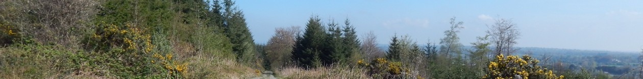
The trail started out on hard gravel path good enough to take a jeep and started gently climbing into the hills. The scenery was definitely of the upper moorland variety and the facilities were quite good with benches every kilometer or so and a couple of boardwalk paths out into the bog.

DSCN2538

The waymarkers were neat and tidy and in reasonably plentiful supply. After about 3 kilometeres I came to the reason for the path closed sign – Fermanagh County Council were busy putting in about two kilometres of boardwalk that went right up the mountain – including a stairway going up about 100m of very steep climb.

DSCN2544

It was all a fine piece of work but not quite finished. The woodwork was done but the anti-slip wire mesh was yet to be put in place. So I was presented with a bit of dilemma but convenience got the better of my sense of right and wrong so I set off along the new boardwalk. It helped that there was nobody around.

DSCN2547

Anyway, the woodwork took care of most of the climbing and left me within a kilometre of the cairn at the peak of Cuilcagh Mountain. Unfortunately, it was pretty misty so there wasn’t a lot to see. Occasionally, the fog cleared enough to allow me to see the next waymarker or the cairn itself.

DSCN2548

After visiting the peak, I turned to the north east and started descending almost immediately. Unfortunately, I missed a waymarker in the fog, so ended up going down quite a steep grass slope with a bit of cliff by way of interruption half way down. I slip-slided my way down and made it down in one piece and a bit damp. There were still bits of snow in sheltered spots on the northern sides of the mountain.

DSCN2549


After making it down, I spotted the well-made track down the side which would have made for a much easier descent. I guess I’ll know the next time. I stopped for a quick coffee and lump of chocolate in a convenient resting spot before heading on across the moor.

DSCN2552

The next few kilometres were a rather damp boring blog-slog across the moor following compass bearings between waymarkers. The track was pretty well set up though and there were neat and strong bridges across most of the streams and rivers that route crossed.

DSCN2554

Aside from the odd stream, it continued on without interruption across moorland for about 5 kilometres until the route came to the interesting little valley of Legacurragh. This looks like a glacial feature.

DSCN2560


At this point I took a little detour as there appears to have been a new trail added since my edition of the OS map came out so I wandered a few hundred metres off course before I realised what I was doing. I’d say I added about a kilometre to my journey with this episode of stupidity.

DSCN2557

Around Legacurragh, there were quite a few odd holes in the landscape. Mostly they seemed to be 40 or 50 metres across and about 10 to 15 metres deepd. There were quite a few smaller holes around as well – you would need to be very careful about straying off the trail as you could quite easily disappear down a hole and do yourself an injury.

DSCN2561

As the ground started to descend towards Florencecourt forest park, the odd tree seemed to manage to cling on to side of the mountain. This little stand seemed to be doing so quite heroicly.

DSCN2563

As I descended towards lower ground, the day began to brighten up a little and the biting rain and mist that had been blasting away for last hour eased off just as I was entering forestry where it wouldn’t have been as much of a problem.

DSCN2564

The route took me onto a forest track and I figured it was getting time to stop for a spot of lunch. I was expecting the abundance of benches I’d seen on the ascent but there wasn’t much in evidence. Eventually after a couple of kilometres I came into the forest park and spotted a convenient stump to rest on and had my lunch.

DSCN2565

The 7 or 8 kilometres of bog-slog had taken their toll and my Gore-text boots had decided to let in water for the first time in the two years I’ve owned them. It possibly hadn’t helped that I’d stuck my feet down a couple of holes along the way. I didn’t bother trying to dry myself out though – just left well enough alone. I wasn’t cold anyway.

DSCN2567

I had the option of a short-cut or of following the Ulster way through the forest park and as it was still relatively early, I took the longer option. There was a pleasant network of forest tracks but the waymarks had vanished so I’m fairly sure I didn’t follow the official route.

DSCN2568

I walked about 4 km through the forest and parkland which was a bit of variety before I started to ascend back towards the mountains to complete the loop walk. I spotted a holly-bush along the way that still had a cluster of red berries so it was’t just ours that got left alone by the birds for some odd reason this winter.

DSCN2573

The weather really started to deteriorate as I ascended back towards high ground and I really started to get soaked. I ended up putting the camera away to avoid damage and just slogged on through it.

DSCN2574

The route ascended along a forest path which went quite a distance into the hills before terminating in this little saddle between two hills. From here on it was a bit of a slog through moorland. I spotted a group of walkers in the distance and I slowly gained on them.

DSCN2540

Somehow I lost them and I ended up joining the road with a bout 1.5 km to go to the car. Along the road, I spotted them again – they had obviously taken a bit of a short-cut. I caught up with them and had a bit of chat. I reached the car without much further ado – quite soaked after my day’s walking. I managed almost 29 km for the day.

338 km

Another Lunchtime Outing

This was my usual loop on a fairly fine Friday afternoon. The weather was very clear even it was a bit overcast and I had a nice walk.

DSCN2526

I spotted this interesting bracket fungus near our resting spot

DSCN2530

There wasn’t really a lot else going on – just a quick lunchtime hike in the forest on the longer of the two loops.

309 km

Normal lunchtime loop

We got out for our usual quick lunchtime loop today. Not a lot of interest going on I’m. It was just a quick walk with the dogs.

DSCN2524

The trees are still showing very little signs of life considering we are nearly at the end of March. While the willows have catkins, nothing has leaves yet.

DSCN2525

Anyway, it was a nice bit of exercise for the day.

304.5km

Fine Spring Day

After breakfast, we took advantage of the fine weather to sneak in a quick loop of the forest. The weather over the weekend really has been fantastic but this often happens at this time of year.

DSCN2521

We weren’t really exerting ourselves as it was just such an enjoyable experience to be up the mountain on such a beautiful day. That being said, it is still quite cold.

DSCN2522

We took the longer loop today for a 4.5 km walk.

300km

It’s starting to feel like spring

It was an absolutely beautiful day to day and was really a joy to be out walking. Although we’ve had a few sunny days so far it is beginning to warm up properly. So we were greeted with blue skies when we went out today at lunchtime.

DSCN2519

There had been a bit of mist earlier but this had cleared away nicely so there were clear views to the distance. We took the longer loop around today.

DSCN2520

So, a very pleasant walk today – at this rate I’ll be discarding my fleece quite soon.

295.5 km

Morning Walk

We all got ourselves organised for a walk after breakfast which was very welcome as a means towards loosening my legs after yesterday’s exertions. It was a fine dry morning and as we weren’t in too much of a rush, we decided to have a bit of an explore of the work that the forestry people were doing back in the autumn.

DSCN2499

For some reason, they dug this rather large hole and there is a corresponding huge pile of spoil just by the entrance.

DSCN2500

After that we went off on the normal double loop but I took the shorter branch as we had a very tired little girl on the walk with us. It was a nice morning for it. It was a fairly unremarkable walk though – we even made it round quite quickly considering.

DSCN2509

I had noticed quite an interesting orange tree-fungus earlier in the week in the ditch on the boundary of our land so I took a couple of pictures at the end of the walk as it was quite pretty.

291km

Marathon on the Miners Way

I got up early and headed for Dowra with the intention of completing the northern section of the Miners’ Way which mostly follows minor roads on high ground down the western side of Lough Allen. After a bit of faffing about trying to find a reasonable place to leave the car I got my act together and headed north out of the village on the R207.

DSCN2437

I didn’t have to spend long on the main road as the route takes a left turn and starts heading up into the hills on minor roads and tracks. There are sheep and newly-born lambs everywhere and their bleating is a constant soundtrack.

DSCN2441

I spend the first couple of kilometres climbing but despite this, the route doesn’t get very high at all over the first 10 or 15 kilometres. It is more a case of up and down over drumlin-type hills. I pass Moneen Lough which is spoiling the view of a mobile chip-shop and a Ford Granada hearse straight out of a Father Ted episode.

DSCN2443

After passing Moneen Lough, the route turns left and we’ve reached the most northerly point of the Miners’ Way. The route now heads south westerly along a remarkable straight minor road for the next 8 kilometres or so. I pass another drumlin lake called Ardlougher Lough.

DSCN2448

From here, it was a case of continuing on straight along the same road. All along this stretch there were fabulous views of Sliabh An Iarainn across Lough Allen but unfortunately the weather wasn’t really co-operating with getting decent pictures.

DSCN2454

A particular feature of the countryside around here is a proliferation of sweat houses – a kind of traditional Irish sauna. These look quite like lime kilns but the door at the bottom is quite a bit bigger. These are dotted all over the place but this one was visible from the road.

DSCN2453

The route crossed the R200 about three kilometres out of Drumkeeragh and a few hundred metres later I came to a nice little bridge at a convenient spot for a rest – about 11km into the walk.

DSCN2455

I had a coffee and a handful of nuts as a snack and paused for 10 minutes or so to take a rest before packing up and getting on my way again. I’d been noticing quite a few empty houses along the walk but this one in particular struck me as a particular pity a kilometre or so after my rest.

DSCN2456

A short while later I came into Drumkeeragh which is a pretty village even if there was a bit of a climb into it. There seemed to be a few places to buy supplies if I needed but I wasn’t really short of anything at this point and so didn’t bother.

DSCN2458

DSCN2459

In Drumkeeragh, the route takes a sharp turn to the left and we start heading south towards Arigna. On the way out of Drumkeeragh, I came across this interesting sign but unfortunately, the path down was too overgrown to have a look.

DSCN2460

After a stretch on local road and a short stretch on a very fast regional road, the route again turns south-westerly and starts climbing along small tracks. It quickly turns to forestry and is quite a a pleasant stretch. For a couple of kilometres the climb is quite steep but the views are quite rewarding if not easily photographed with the lingering haze.

DSCN2465

After this brief climb, I get a bit of a rest as the road contours around for a couple of kilometres before starting back down towards the lake. The views along this stretch are quite spectacular but you really would need a fine summer’s day to get the full impact. I was also treated to the spectacle of two cock pheasants having a fight but my presence scared them off before I could wake the camera up.

DSCN2467

I narrowly escaped making a rather bad navigation error along this stretch and the route forks with the wilder section heading off up into the hills. As I’m heading for Drumshambo today, I take the easier route downwards. At this point, I’ve just passed the 20km  mark and as I had a relatively light breakfast it is time to stop for lunch. Luckily enough the route leaves the road here and heads through a ruined farmyard, where there is a nice little copse of trees to sit down for a break.

DSCN2469

After a nice lunch of soup and tuna rolls, I got going again. The route here takes a short detour through some fields but it was a bit of a slog through mud. Mud was about to feature quite a bit in the walk for the next few kilometres. I was back on the road soon enough and the route took me quite close to some wind turbines.

DSCN2471

Shortly after this I passed the point where the route splits up over the mountains. It would have been nice to head further up but my objective was Drumshambo and those were my arrangements for getting collected. So I started down as the route passes back towards Lough Allen again.

DSCN2472

There is a lot more evidence of various industrial quarrying that has been going on in the area of a long time. Along this stretch there were more great views across the lake – the mists somewhat cleared but it was still quite hazy.

DSCN2475

A short time later I passed a rather lovingly maintained public water pump but it didn’t appear to be working. I can remember using these as a child – mostly for the novelty value but they usually still worked even if they required priming with a supply of water that was left near the pump. Alas this wasn’t to be the case with this one.

DSCN2477

For the next few kilometres the route took quite a few detours off roads and these detours were generally a bit of a slog as they were through farmland and in some cases through farmyards. They were also quite winding and I found that I had underestimated the distance to Arigna by a few kilometers and this was quite draining since it coincided with the general state of exhaustion I find sets in shortly after the 30km mark.

DSCN2479

While the view at the top was lovely, I was none too pleased to have to zig-zag my way up this. However, I was starting to come across some more signs of industry as I got closer to Arigna. There are still a working stone quarries in the area.

DSCN2482

The stone in the area is particularly useful for building as it splits into reasonable size lumps with very little cutting. There were once small quarrying operations all over the area but the recent building collapse has put paid to a lot of them. This once seems to be going quite well.

DSCN2480

This is the raw material – you can see how easy this would be to split up for building. The route goes off-road again for a couple of kilometres towards Arigna and I come to this amazing relic of an old aerial ropeway that was used for mining operations in the early part of the 20th century.

DSCN2484


After a little while, still suffering through waves of exhaustion I finally made it to the Arigna Mining experience centre where amongst other  bits of rubbish I saw these interesting looking mining carts with old CIE logos on them – one of them even has the old Flying Snail logo.

DSCN2486

There were loads of bits of utter junk lying around and I wasn’t going to hang about too long as I didn’t have an awful lot of time left and I still had about 7km to go to Drumshambo.

DSCN2488

I stopped for a quick coffee (from my flask) and a rest at the bottom of the road into the Mining Experience and headed down into the village of Arigna. It is not exactly a pretty village but I guess that at least there is industry to keep people busy.

DSCN2489

After a quick stop in the shop to buy a bottle of Coke to try to keep me going the route takes a rather interesting turn along the trackbed of the old Cavan and Leitrim railway although there is nothing to announce this.

DSCN2490

This continues on for about three kilometres and the going is really good along this section. My energy recovers and I manage a couple of 12 minute kilometres. I’m not sure if this is due to the Coke or having just passed the point of exhaustion.

DSCN2493

The railway eventually runs out and I’m back on a regional road for a few hundred metres. After crossing another road, the route takes another detour through some fields. I come across my second “Beware of bull” sign. I’m not really sure what you are supposed to do here other than abandon the walk but as for the previous case, the bull was nowhere to be seen.

DSCN2494

At the house in the distance I set a farmer’s dog off in a frenzy who then chased some cattle out of a yard right past me. The farmer seemed fairly nonplussed about the incident and I stopped for a quick chat. At this point I was only about 3 km from my destination so I pushed on.

DSCN2495

I crossed the Shannon at an ESB facility and I was still making good time. Shortly after this I came across another of the impromptu scrapyards that seemed to be about – I think this was about third of the day. It had this poor sad relic of a Citroën 2CV lying about.

DSCN2497

The last feature of note on the way into Drumshambo was this canal lock. At this point my walk was nearly done as I was about a kilometre from the town centre.

DSCN2498

I actually didn’t bother walking right into the town centre as I spotted a nice bench to have a quick sit down on and right as I did so I got a text message saying that my lift had arrived. I probably should have walked the extra couple of hundred metres but I really couldn’t be bothered. So I left it at 43.4 km for the day.

287km

Properly sunny walk

We’ve had an amazing swing in the weather over the last couple of days so at lunchtime today I had an absolutely fabulous spot of weather for my walk.

DSCN2436

I didn’t really notice a lot going on as I spent most of the walk lost in thought about what I was doing for the day. I took the longer loop but that’s really about it.

243.5km

Very late berried Holly

This was just a quick lunchtime loop after a horrible morning. But luckily enough it cleared up around 11:30 and it was actually quite sunny by the time we were ready to go.

DSCN2430

As we were late, it was the shorter loop again. Amazingly the holly is still in berry which by far the latest I have ever seen it.

DSCN2434

I wonder if it is something to do with the tree felling work that was going on a few months back. I had noticed that the forest was uncannily quiet this winter with no birdsong at all. So perhaps the work scared a lot of the birds away.

But at least they are coming back now. We’re almost into dawn chorus territory but not quite yet.

239km

Touch of Spring

I had a few bits and pieces to do during the day and it was really looking like I wasn’t able to get a walk in. But luckily enough, I caught my moment in mid-afternoon and got out before I had to make the dinner.

DSCN2427

It was a fabulous spring day with blue skies. But it was still a bit windy and quite cold as could be expected at this time of year. Still I got a nice walk in.

DSCN2429

The willows are in fine form – we should start seeing leaves quite soon I reckon. I took the short loop as I was in a hurry.

235km