Tag Archives: royalcanal

Canal Walk – Hill of Down to Enfield

So, suitably refreshed after a nice lunch of Tuna roll, crisps and a can of Coke, I pushed onwards. The heat really was starting to get to me at this stage and as usual it was beginning to stop being fun. But I still had 14 km to go and was on a reasonably tight deadline for a train at Enfield. So I had to just put the head down and get on with it. The railway was pretty much a constant companion at this stage with the odd milepost being visible. The railway is the only transport mode in Ireland still using miles.

DSCN0853


There is lots of canal activity visible in this shot with both cyclists and canoeists enjoying the fantastic weather. I must admit, that at this point I was praying for less fantastic weather and was trying to find shade wherever possible.

DSCN0856

The next major feature on the canal was the Boyne aqueduct. This is another landmark I have seen hundreds of times from the train but had never set foot on. There was quite a nice view of the river from here but it was a bit of a major diversion to try to get a picture of the aqueduct itself.

DSCN0858

The county boundary took  a bit of a diversion a this point and I had to wait another 5 kilometres or so until crossing the Blackwater to pass into county Meath. My pace had dropped below 5 km per hour by now and I was having to stop to take a rest every hour given I was now knocking on the door of 35 km and was in a bit of pain. I stopped for a quick chat with a couple of boaters at Moyvalley and then came out onto the old main road at Furey’s.

DSCN0862


Much as I would have loved to stop for a pint, I was looking nervously at my watch as I was going to be cutting it really fine for a train or face waiting at Enfield for two hours. So I pushed on as fast as I could. After Moyvalley, the path got quite overgrown and it was really pleasant. There was quite a bit of shade about and it was a very welcome relief for the sun.

DSCN0864

At about 40 km, I decided to chance another quick rest. I had a bit of a sit down, ate a chocolate bar and drank the remains of one of my (long-thawed) frozen bottles of mineral water that I use for stopping my chocolate from melting. This gave me another burst to finish out the walk.

The next feature was the Blackwater aquaduct which finally marked my transition into County Meath and left me with about 3 km to go.

DSCN0867


From there on in I was on the home stretch and the sore legs and feet didn’t really matter any longer. There were a lot of teenagers hanging about Enfield harbour enjoying the fine weather.

All of a sudden, I spotted the bridge at Enfield station and knew that I had only a couple of hundred metres to go. I got into the station about 10 minutes before the train was due but I needn’t have been that rushed as Irish Rail weren’t too rushed either and the train was about 15 minutes late.

DSCN0873


Canal Walk – McNead’s Bridge to Hill of Down

So without much of a pause, I pressed onwards from McNeads bridge for a few kilometres. When I spotted a sign for a bar and grocery shop at Killucan, I left the line for a few hundred metres to replenish my water supply. I got another 2 litres of water and replenished my water bladder from what I had. It was turning into quite a hot day and I reckoned I was going to need whatever water I could carry.

DSCN0818

Immediately after Killucan I hit upon my first lock of the day and over the next 5 kilometres or so the route dropped through about 10 locks from the summit. I’ve taken pictures of most if not all of the locks but it gets a bit boring after a bit so I’ve not bothered uploading them all.

DSCN0823


There were quite a few people about partaking in various canal-side activities.  I met a few local walkers, runners and the odd cyclist. The route in this part of the canal is particularly suited for cyclists with pretty much uninterrupted paving along the canal all the way from Mullingar.

I had done a deal with myself to have lunch at or around the half-way point but then I realised that I had managed to talk myself into doing the walk by persuading myself that it was about 4 kilometres shorter than the 44 km that the walk was planned at. So I left the 20 km behind with this harvesting operation being the only thing of note to see.

DSCN0833

The day was getting so hot that I resolved to go for a quick swim when I got significantly past half-way. I wasn’t really feeling particularly hungry so I decided to leave lunch for a bit longer. So at 24km, I had a quick dip in the canal which was indeed very refreshing. It wasn’t as cold as I was expecting but it was certainly a relief from the heat of the day.

While I wait to dry off I had a bit of a rest and admired the various insect life buzzing about. There were fantastic dragonflies but they were too fast for my bridge camera to be able to nab a quick shot. So I satisfied myself  with a coupe of shots of this butterfly which was quite fabulous.

Butteryfly


So resting aside,  I got my act together and kept myself moving. Every now and then I would come across a heron who would promptly take off and move elsewhere. This guy was on the other side so wasn’t too bothered about me

Heron

So from this point, it was another couple of kilometres into Hill of Down where there was a lovely little harbour and they were setting it all up for a bit of a festival. There was what looked like a nice pub with tables outside but again, I was loaded for the day and in any case it was a bit early for partaking. I reckon you could easily take on this section without too much in the line of supplies as there were a few spots to get food.

DSCN0852

So I pushed on for another couple of kilometres until I came to a reasonable looking spot with a bench to have a bit of lunch.

Royal Canal – Mullingar to McNeads Bridge

I got up early and drove to Mullingar as the first train was just a little late to be getting started. I was on the trail by about 7:45 which was about when I wanted to be setting off. The day was shaping up to be a real scorcher but I had my sun-hat, sun-screen, 4 litres of water and the prospect of being able to stock up on water en-route.

Just before I got to Mullingar harbour I come across this interesting railway bridge that I must have crossed closed to 4,000 times over the last 10 years yet have never seen once from the other side. This is going to be a common feeling for the day as I’ll be following the railway line that I commute on and will be seeing lots of things for the first time that I caught as a glimpse from the train hundreds of times before. You can see from this bridge, that the stone structure is capable of carrying a second line but this line was singled nearly a hundred years ago and nobody has saw fit to restore it since.

DSCN0789

The first part of the walk is a great loop that the canal takes around Mullingar. As I am on the summit level and the town of Mullingar is in a hollow, a more direct route is impossible and even with the loop the canal is on large embankments for a lot of the time. The scale of the engineering involved here is pretty impressive when you consider it was constructed entirely using manual labour,

Mullingar harbour was looking particularly peaceful. There were a few people about walking dogs and getting a quick run but the town really hadn’t woken up yet. The canal is quite extensive and even has a dry dock.

DSCN0790

The other feature of note in the Mullingar loop is that this is the point where the main water supply comes in  Lough Owel. This is another feature that I shoot by on the train every day yet never see. This little bridge crosses the supply channel as it joins the canal. Back in the day this channel did most of the work in keeping the summit level but in these days of pumps, there are several other sources of water which is pumped in from the Inny at Ballymahon and from the Brosna. This is mainly because the council now takes a lot of water from Lough Owel and so the lake is no longer capable of supplying enough water to meet all demands. So the main supply no longer supplies a major component of the water for the canal at all.

DSCN0792

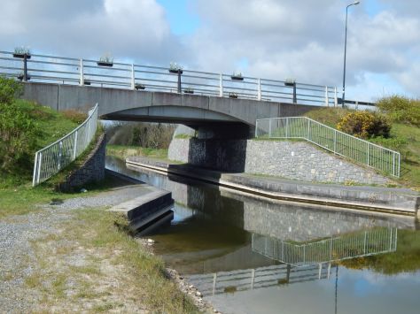
Another kilometre or so saw me at the other side of Mullingar and once I was done there that was the last I’d see of towns of any size until Enfield. There is a small bridge a this end of the town that is big enough for boats but forces walkers across the road.

DSCN0793

At this stage I was beginning to hit my stride and so got moving at a good rate along the line. The path was a mixture of tarmac and compacted gravel and was a good surface if not a little hard of the feet. There were fabulous Irises in flower – well some sort of Iris or Lily, I’m not that bothered about looking them up.

DSCN0798


A bit out of Mullingar and we entered into an area that looked to have been cut out of rock. It was quite a deep cutting and the path rose to about 7 or 8 metres about the canal in places.

DSCN0801


After this, the country opened out a bit and we rejoined the railway which was to stay our relatively close companion for the whole journey. At about 9 o’clock, I got to The Downs where the main road also joined the canal for a bit of company.

DSCN0806

This continued on and off for a few kilometres although it wasn’t much of a disturbance as it was on the other side of the canal and there were plenty of trees keeping the volume down. I stopped for a cup of coffee around 9:30 in a nice quiet spot opposite a farm. I didn’t stop for long and pushed onwards. I came across this rather bizarre-looking contraption of a lifting bridge.

DSCN0811


From there it was about 15 more minutes to McNeads bridge and Mary Lynch’s pub but I was so early that they weren’t even open yet. Even so, I probably wouldn’t have bothered as I’ve gotten in the habit of carrying what I need for the day. There were a few boats moored up at the bridge but there didn’t seem to be much signs of life apart from a Waterways Ireland pickup truck.


DSCN0815

Although I didn’t stop here, this is natural point for a page-break given that it is a major place of interest. I’d made good progress over the first 2 and a half hours of my walk with about 12km put behind me. There was still a long way to go though.

DSCN0816

Canal Walk – Lock 41 to Clondra

After I had eaten, I managed to refill my water bottle from the tap kindly provided by the people in the lock keeper’s cottage and pressed onwards. For some reason I came to the conclusion that I had only 10 km to go but on reviewing it later, I would think it was closer to 12 or 13. It was getting to be a bit of a slog as it really was getting quite hot and there was very little shade available.

DSCN0484

Before long I can to Island bridge near Kenagh and followed the trail onwards. However, a few hundred metres up the line I came to an open gate with a building site notice posted on it across the way. I checked the map and decided that I had best back-track up to the bridge and go up the opposite bank. I thought that was a bit of a bad show on a waymarked route to just have it blocked by Waterways Ireland and have no detour posted but as it was a bank holiday weekend no harm was done and I guess it would have been different with workers around.

DSCN0487

Anyway, I headed off down the other bank and soon came across some parked machinery so it was obviously a site as well even though there was no notice posted. I got past it all and eventually came to a fence at the other end that blocked the way and announced the bank closed. It was just as well I was going the direction I was as otherwise I would have had to figure out a detour on local roads but I can’t help wonder at the strange decision to close both banks with no notices posted.

DSCN0485

By now I was starting to get really tired and was becoming quite a struggle The next feature of note was the abandoned Longford branch which meant I had about another 2 km to go to Killashee and another 9 or so overall.

DSCN0497

After struggling for another 20 minutes or so I made it to Killashee and had a bit of a rest. I checked the map and figured I had another 7 km to go so another hour and a half should suffice. The rest of the walk was a bit of a blur – really open countryside with very little shade. There were a few interesting features as I approached the end of the line. This lifting road bridge was about 3 km from Clondra – again part of the legacy of Longford Council filling in the canal to make the roads a bit faster.

DSCN0506

From here on was a bit of bogland and the first I saw of this was this interesting lifting narrow-gauge bog railway bridge. These narrow-gauge railways are by far the largest rail freight operation in Ireland and the total network is roughly the same length as the main Irish Rail network in the country.

DSCN0510

The bog around here is mostly played out and there is much planning under way right now as to what to do next with these vast open spaces, many of which need to be continuously pumped to stop them from flooding. There is much opposition to plans to install large amounts of wind turbines for electricity generation but whatever happens will be preferable to the decades of abuse the land has received at the hands of commercial peat extraction.

DSCN0511

This little railway left me with about 2 km to go and I was very relieved indeed when Clondra finally came into sight. The harbour was buzzing with people sitting on their boats and I would guess the pubs were regretting the loss of a fine day’s trading due to it being Good Friday.

DSCN0516

The end of the line – Lock 46. This is the end of the Royal canal where it joins the river Camlin and proceeds by way of the Clondra canal to the Shannon. Note the local spelling of Clondra – for some reason the OS spell it Cloondara but as I’m from Longford, I’ll spell it properly. The village is named from the Irish, ‘Cluain Dá Rath’ which means ‘Meadow of the two ringforts’.

DSCN0517

Canal Walk – Ballymahon to Lock 41

So, somewhat refreshed I set out westwards again although I was nearing the point where the canal turns north towards Clondra. The first feature I had to go under was an ugly modern bridge that takes the R392 over the canal. It is only over the last few years that the canal from this point onwards has been navigable. In a fit of madness in the 1970s, Longford county council decided to remove and/or replace 5 or 6 canal bridges and just run roads through the canal. This was the main stumbling block against getting the canal re-opened and was only properly resolved about five years ago.

DSCN0468

So this must have marked the old westward limit of the canal because I have childhood memories of having been in the line of the canal with my dad who was a keen botanist and there were lots of interesting things to be found in the marshy ground where the canal once was. The next bridge I came across, Archie’s bridge is burned into my memory for some reason as a place we used to come to walk as children. It is an absolutely standard piece of canal architecture yet like so much else about the canal it is a perfectly functional structure that does what it needs to do and nothing else.

DSCN0469

As the day was progressing the cowslips were finally beginning to open out. This specimen was particular awake on the bank at Archie’s bridge

DSCN0470

After Archie’s bridge and the lock at Mullawornia, the country started to turn a bit more interesting.

DSCN0473


While not quite as twisty as the section near Abbeyshrule, the line started meandering a bit to avoid the need for locks. The canal seemed to be cut into the side of hills quite a bit and I was treated to this vista of Drum lough

DSCN0475

At this point, the weather really was getting quite hot. I was beginning to get concerned about my supply of water as I had brought a total of 3 litres with me for the day and I had no idea as to where water was available. It is apparently possible to get water at each harbour but I’ve only ever managed to find the tap at Coolnahay near Mullingar.

After passing the R392 again through a rather elaborate built section of wall and modern bridge, I took another quick rest for a coffee and a few nuts

DSCN0477

I changed out my map as I had now walked off sheet 41 and did some estimates of what was remaining. Unfortunately I did manage to mess up somewhat and severely underestimated the distance remaining after Kenagh.

DSCN0479

I pushed on for a bit and came to one of these strange bridges which doesn’t seem to have a purpose. I went up on it to take a look and saw this farmer walking around a field staring at his feet. As I was whistling, he must have heard me and came down to have a chat. He had obviously also been on his own for the morning and felt the need to explain that he was trying to find out where his fertilizer had run out. We passed the time of day for about 20 minutes and he offered me some well water if I wanted to walk up a few hundred yards. However, heedful of the aforementioned slurry spreading, I politely declined. He did explain that the bridge had been built for farming and that the canal company had offered the local community (or more likely the gentry) £100 not to build the bridge but they had refused.

DSCN0480

Anyway, I pushed on for another few kilometers to Lock 41 which I decided was a nice spot for lunch so I took a break there to have a tuna sandwich and some coffee.

Canal Walk – Abbeyshrule to Ballymahon

The time had come to set out on my next chunk of canal walk which was from Abbeyshrule to Clondra but I have broken it into a couple of posts to avoid them becoming overly long. I set off from the Whitworth aquaduct at Abbeyshrule with Clondra as my planned destination for a walk somewhere between 35 and 40km – it is difficult to be more accurate because the canal is quite twisty of a good section of the route.

DSCN0438

I had a foggy start at about 8 AM and the weather app on my phone was showing -1C as the temperature although I think it was a few degrees higher. I set off at a good pace and was soon through Abbeyshrule without much fuss. This section of the canal is a lot less remote than the section the other side of Abbeyshrule and there were plenty of houses and roads nearby. Indeed, close to 10 km of the route is actually on minor roads.

I saw a couple of cowslips making an appearance although they hadn’t really managed to open out yet thanks to the heave dew due to the fog.

DSCN0454

I stopped for a coffee after an hour at Guy’s bridge and had to drink it standing up as there was nowhere to sit. This section of the route is exceptionally flat. There are only 5 locks over the whole walk, one of these is at the very end and two of them are within a kilometer of each other, so the option of having a coffee while sat on a lock gate rarely presented itself.

After that quick break, I kept the pace up and passed the N55 at Toome quite quickly. The countryside here is not spectacularly interesting – it is all good pastoral farmland and for large tracts, given the time of year, the dominating smell was that of slurry as the farmers are spreading in earnest now that the heavy early spring rains are done with. By now the fog had lifted and it was turning into quite a nice day.

DSCN0456

At Toome bridge I had to take my chances with a herd of cattle who had set up camp on the path. I saw this kind of thing a few times where farmers had obviously annexed sections of towpath during the long years the canal was completely closed. There were numerous fences to be crossed on this section of walk and in places it got quite irritating.

It was a relief to make it to Ballymahon harbour for around 10 AM which was a good pace to start the day off with. I make the distance around 13 km so that was a good start to the day. To celebrate I had a cup of coffee and a snickers bar.

DSCN0459

It was nice to sit there at the harbour and watch the place wake up. There are a few houses around Ballymahon harbour and people were slowing getting themselves started for the day and I’d already done 13km. The day was beginning to warm up so I stowed my winter hat in my bag as I wasn’t really going to need it. It really was looking at turning into a fantastically warm day.

DSCN0461

There were a few swans and ducks to keep me company.

DSCN0463

So I packed up and set off on the next section which I probably won’t get around to writing up until tomorrow.

More Canal Exploring

We went on a nice little family walk on the canal on today just by way of a day out. We set out from Abbeyshrule heading towards Ballymahon but only did about 4 km down the canal before returning. It was a fine day and there was a nice playground for the kids.

It was nice to see a bit more colour in the flora.

DSCN0382

Our very silly dog was trying to figure out if she could get herself a nice duck. Not that she would know what to do about if she did.

DSCN0397

The ducks in close-up. Just messing with the camera really.

DSCN0395

Canal Walk – Part 3

Coolnahay was a pretty little place that had two picnic areas, a little tea-room operating out of a lock-keeper’s cottage which was even open on a Friday in March. I felt a bit bad in that I was fully stocked with coffee and lunch but I sat down at a bench by the harbour to eat. I had a nice lunch of tuna roll, crisps and coffee. I left the woman a small donation (they had a sign saying donations welcome) as I felt bad about using their facilities. There was water available there as well but I took stock and figured I had enough to get me to Mullingar and didn’t need the weight. I got the map out and reckoned on being able to make Mullingar with about half an hour to spare for the 4:10 train so long as I didn’t faff about.

2014-03-21 13.10.32

I met four people walking around Coolnahay and excluding the woman in the shop in Ballynacarrigy, these were the only people I saw for the entire day.

A little bit further on I came across this modern intrusion on the landscape which is Shanonagh bridge. At this point I was getting a sense of being on the home stretch but the weather was getting a bit nasty. It was a little uncomfortable but not a real problem thanks to my rain jacket and moleskin trousers.

DSCN0294

After another couple of kilometres I came into Ballina where we joined the disused Athlone to Mullingar railway for the last 5 km or so into Mullingar.

DSCN0305

I was getting pretty tired at this stage but with the end in sight I was moving fairly well. As I headed closer to Mullingar,  I came across this odd looking memorial cross

DSCN0314


When I got home, I looked this up and it turns out the Mary Walker was brutally murdered at this spot in 1909 and a man was hanged for the crime about six months later. It all looks quite gruesome – I will probably read up about it if I can.

Closer to Mullingar, I came across more disused rail infrastructure. I had never realised how big the railway yard was in Mullingar. There was the huge amount there and it’s all just falling apart. 

DSCN0319

DSCN0326  DSCN0334

So finally after 6 hours and 10 minutes, 10 minutes longer than estimated, I made it to Mullingar station with about 40 minutes to spare for the 1305 from Connolly to Sligo. I changed into a clean t-shirt and fleece so that I wouldn’t stink out the train and got back to Edgeworthstown in 20 minutes on the train.

DSCN0329

Canal Walk – Part 2

Emper

At Emper (or at least where there was a sign saying Emper, I think the place itself was a kilometre or so away), I’d been walking for an hour and so decided to take a break as there was a nice comfortable lock to sit on. So I poured myself a cup of coffee and had a little bit of own-brand Snickers bar.

DSCN0248

After this little break, I packed up and headed on towards Ballynacarrigy which would be the only village of any size I passed through until Mullingar. The terrain was rising a little at this point and there were another two locks to pass through.

DSCN0252


I left the path for a minute in Ballynacarrigy to nip into a shop as I was concerned I didn’t have enough water and fancied a banana. After buying some water from than must have had gold in it considering the price from a strangely bare shop, I pushed onwards without another break. This is Ballynacarrigy harbour.

DSCN0257


I did another couple of kilometres until I came across another convenient lock to take a break on and had another cup of coffee and helped myself to a handful of nuts. While I wouldn’t say it was getting hilly, the terrain was certainly a lot less flat and I came across a sequence of three locks in a few hundred metres near Kildallan bridge.

DSCN0270

There were a few beautifully kept lock-keeper’s cottages on this stretch although some had fallen into complete ruin.

DSCN0271


At this stage, I was starting to get hungry and I reckoned I was around the half-way point so it was getting time to stop for lunch. I resolved to give it one more lock before stopping and the I came across the beautiful little harbour of Coolnahay and stopped there.


Canal Walk – Part 1

Abbeyshrule to Emper

I’m not counting this as one of my days but I’ll post on it here anyway. As I’ve been having a pretty rough week and was pretty seriously stressed, I decided I needed a big walk to clear my head. So as I’ve been toying with the idea of doing the Royal Canal way for the last while, I decided that it was a good time to get started on it. So, I took a day off work and got a few snacks and got myself ready to go.

I’ll break this into a few posts as the entire walk covered about 30km, took 6 hours and I took 120 photographs.  The plan was to walk the section from the Whitworth aqueduct in Abbeyshrule to Mullingar. I toyed with the idea of bringing one of the dogs, but as I didn’t really know what to expect, I gave that idea a miss. It turned out that I probably could have managed to bring the younger of our two dogs. Poor old Sally probably wouldn’t have been up to 30k since she generally has a few hours’ kip after the 5k local loop.

Anyway, it was an overcast but reasonable morning when I got dropped off at the aquaduct. There was some messing going on where some muppet with a truckload of avgas for the local airfield had tried to go across the aquaduct but thought the better of it and was reversing out but once he sorted himself out, I was on my way.

DSCN0221

The aquaduct carries the canal over the River Inny and makes getting in and out of the village of Abbeyshrule impossible without crossing water – or at least it makes it very confusing. Just after that I met a woman who was walking her dog who was the last person I would see for some time.

I’d walked a couple of kilometres up from Abbeyshrule, to the point of this very odd bridge which is in the middle of nowhere, has the remains of a road going up to one side and nothing at all on the other side. Perhaps there was a great house there at some point.

DSCN0233The next few kilometres were pretty featureless with only the occasional bridge to break up the view. But I quickly realised that it was an amazing perspective on the countryside as I was in utter solitude. Where I normally walk and in pretty much all of the midlands, humans generally intrude upon the soundscape in that there is always the distant rumble of traffic or somebody running a chainsaw. But out in the middle of this stretch of canal there was no human sound aside from one or two overflying airliners at cruise altitude. So I pressed on for an good hour or so in glorious solitude with only the sound of the wind and the birds.

So for the rest of this section of walk, there was a lot of views like this. For my first 5km or so, the ground was dead flat until I came across my first lock at Emper. I’ll stop this post at this point as it is getting a bit long.

DSCN0236