I’ve been trying to get a start on the Miners’ Way which loops around Sligo, Leitrim and north Roscommon through an area which was once widely mined mostly for coal and lignite. It isn’t so much one walk as a network of trails that totals up to around 150km. So there is a lot to cover.

For my first day on the way, I’ve started out in the village of Keadew in north Roscommon and set out on a waymarked loop of slightly more than 25km. Quite a bit of the walk is not actually on the Miners’ Way but we’ll not worry about that for now. I got an early start – on the walk before 8 and after a couple of kilometers of road walk, I was on a trail up the mountain.

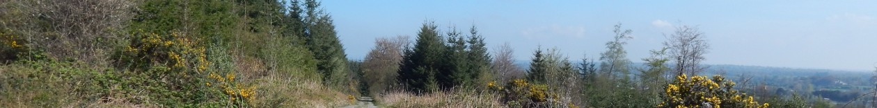
It was a hazy kind of morning so I’m afraid I don’t really have any great distance shots. The way was clearly marked with yellow markers and there wasn’t a lot of need for the map. However at about 4km in where the Kilronan loop splits off from the Miners’ way, it was certainly a lot more useful.

At this point the markers turned red and we were admonished with severe warnings about leaving the track due to prevalence of old mine shafts in the area. There was an interesting sign accompanying the cairn in the shot below. This was put up to celebrate a Sinn Féin election victory in the 1918 general election.

Shortly after this I hit point where the two trails diverged so after a short break to put a strap on my map case and to get my wind-cheater out I set off along the trail of the red markers. These wound around a bit but they were well laid out and it was easy enough to follow the trail.

This trail lead me up towards a wind-farm which runs along this section of the ridge. There is quite a bit of stuff up in these mountains, between wind turbines, mobile phone antenna and various other bits of telecommunications infrastructure.

After passing the windfarm, we started going downhill a bit quite shortly and the track deviated off towards the left. I had a quick break for coffee and chocolate before pushing on through a gap in some forestry.

The trail emerges from the forest into the yard of an abandoned mineworks which is quite interesting. Unfortunately my camera was struggling a bit in the poor light so I don’t have any decent pictures of this.

After leaving the mineworks, we rejoined a minor road for a few hundred metres before turning off to a paved track that probably used to be a road. The waymarking which until now had been excellent had a few gaps in it at this point but I found my way with my map. so no real problem.

There were still a few bits of snow about from the fall last week but only in very sheltered spots.

The views in this area are quite spectacular but the weather wasn’t terribly conducive towards getting any good pictures. The track started to peter out a bit into a rough green track.

All was going well until I came to a fork in the track and there was no waymarker to be seen. One of the tracks looked like it only went on for a hundred metres so I took the other which turned out to be a bit of a stupid mistake. This took me down off the mountain about 2 km too early but no matter, it was still a nice route.

I figured out where I was and after a bit of a detour and probably a kilometre of a shortcut, I rejoined the proper route at a pretty little bridge where I decided to stop for a coffee. Suitably nourished I set off again and exchanged greetings with a local farmer out for a walk. I spotted my first primrose of the year.

At this stage it was mostly a question of getting the head down and making some distance and there was not a lot of interest for a few kilometres as the route proceeded along some very minor roads until it joined the R284 for a hundred metres or so to cross the Feorish river at an interesting waterwheel. There are bits of industrial heritage all over the place around this part of the country.

The route quickly leaves the main road onto an interesting little path that goes fairly directly along above the main road.

From here it was a couple of kilometres into Ballyfarnon where I found a lovely spot by the river to have my lunch. I had a grand feed of soup and a roll and a bit of a chat with a guy who was wondering why his dog was barking so much.

Ballyfarnon, like Keadew is a lovely little village with some traditional shopfronts. It was all very sleepy though a one o’clock on a Friday.

I settled into the last stretch of the walk which turned out to take quite an interesting route through an old demesne which is now a posh hotel and quite a bit of forestry. A good part of this was on the side of Lough Meelagh which lead me almost to Keadew.

I took a bit of a detour to go out to Doon point as there was a promontory fort marked on the map but I didn’t see much of it. Still it was a nice view. The path here continued right along the side of the lake and it was very pleasant even if seemed as if we were being kept out of sight of the more desirable hotel guests.

This continued on for quite a bit until we came to a quite spectacularly gaudy celtic tiger relic of a gatehouse that wasn’t even finished. It made for a bit of a laugh anyway. The mind boggles as to how somebody would be allowed build such a thing.

The old gates a bit further down were much nicer even if the original gatehouse was just a ruin.

By now I was just a couple of kilometers from my end-point but the last bit did not look promising according to the map as it was along a busy regional road which should strike terror into the heart of any Irish walker. These roads tend to be populated with manic truck drivers who see the 80kph speed limit as a target to be beaten rather than a limit and seem to spend the day with a mobile phone glued between their shoulder and their ear.

So I was very pleasantly surprised when I found that they had actually made a little path between the road and the lake and I didn’t have to go on the road at all. There were bits of forest and the I even spotted a few mushrooms along the way.

This was a perfect end to a very pleasant day’s walking and as I came into the village, the way turned off the main road altogether and up a hill for a hundred meters or so before leading us into the village by the church. I made it a total of 26.5 km over 6 hours which is a bit slower than my flat walking speed but not dramatically so – I would say the route took me about 45 minutes longer than the equivalent canal walk.
226.5km